
Light snow will continue to fall in the Colorado mountains on Sunday as rain sweeps across the Front Range, according to National Weather Service forecasters.
Drivers on Interstate 70 and U.S. 40 should plan for winter weather conditions in the mountains, with up to 2 inches of snow possible near Pikes Peak, the western Mosquito Range in Lake County and eastern Sawatch Mountains.
Scattered showers will dissipate by Sunday afternoon, though cooler weather will stick around until Monday, when highs will return to the 70s.
There was less snowfall than expected overnight Saturday, with just a dusting on Vail Pass; an inch at Arapahoe Basin and Eisenhower Tunnel; 1.5 inches on Berthoud Pass; 2 inches on Hoosier Pass; and 3 inches in the mountains of Boulder County, according to NWS.
Today’s Precipitation Probabilities for your local town or city. Additional rainfall amounts range from .01 to .25″, mainly for areas from Longmont to Akron. #COwx pic.twitter.com/fgCud3GD46
— NWS Boulder (@NWSBoulder) September 22, 2024
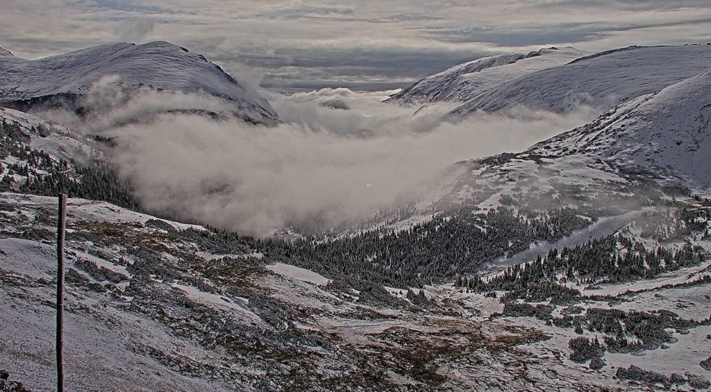
CO is showing off again! Check out the view of our first high elevation snowfall from RMNP’s Alpine Visitor Center this morning. I don’t know about you all, but we are certainly looking forward to clearing skies this afternoon to get a peek at those snow-capped peaks! #cowx pic.twitter.com/NJ22YuE5gG
— NWS Boulder (@NWSBoulder) September 22, 2024
The post Light snow in the mountains, rain across the Front Range appeared first on Patabook News .