TLC famously said don’t go chasing waterfalls. But during the Colorado summer, there are few more fun things to do than hop in the car, hit the trail and bask in the spray of cascading snowmelt.
We designed four different road trip routes that start in Denver and take drivers to some of the state’s best waterfalls. They vary in distance and region, so you can choose one that fits your schedule and destination preferences.
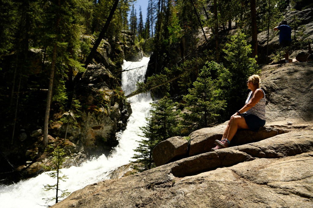
The waterfalls on these itineraries are just as variable. Some can be viewed from easily accessible overlook areas and short, paved paths, while others require a moderate or potentially arduous hike to view the falls. By now, most trails should be melted, but it’s worth doing extra research to ensure you’re well-equipped for each respective environment.
Lastly, remember these are just suggestions. The perfect waterfall road trip isn’t defined by how many Instagram-worthy destinations you check off a list, but rather the memories you make along the way.
So start your engines, the waterfalls are waiting.
Route 1: The south loop
Estimated drive distance: 334 miles
Travelers looking to stay relatively close to the Front Range have waterfall options before they even stray from I-25. Start this journey at The Broadmoor Seven Falls in Colorado Springs, a storied and well-developed tourist attraction that takes you to multiple waterfalls in less than a mile’s walk. (Requires an entry fee; $13-$19)
Thereafter, hop in the car and head west to the Buena Vista area where there are waterfalls aplenty. Agnes Vaille Falls Trail in Nathrop, Colo. is one of the most accessible requiring a short out-and-back hike with about 500 feet of elevation gain. Another popular option nearby is Browns Creek Falls, though the hike to get there is much longer.
Enjoy a scenic drive north before stopping at Staunton State Park near Conifer for a lengthy trek to Elk Falls. Thanks to a new parking lot, the hike has been shortened to 8 miles from 12 miles, and our resident outdoorsman said the falls are worth every step.
The last stop on this road trip is just a short drive to Conifer where you can see Maxwell Falls by hiking a roughly 4-mile loop before heading back to Denver.
Route 2: The extended south loop
Estimated drive distance: 650 miles
If you have a few extra days, you can make a larger loop by starting with The Broadmoor Seven Falls and then heading south to hit Zapata Falls near Alamosa, billed as a rocky oasis surrounded by desert.
From there, venture to North Clear Creek Falls near Creede, which cascades more than 100 feet down canyon cliffs. This one doesn’t require much of a hike, as there is an observation point that’s accessible by car.
To make a loop, swing through Lake City. If you have enough time and the right kind of vehicle, you could traverse Engineer Pass, which includes several waterfalls. Otherwise, hit Gunnison and then head east toward Agnes Vaille Waterfall in Nathrop and back to Elk Falls in Staunton State Park or Maxwell Falls in Evergreen, or both.
Route 3: I-70 and north loop
Estimated drive distance: 523 miles
I-70 may be one of Colorado’s busiest highways, but it’s also an apt thoroughfare for waterfall viewing. Drivers starting in Denver could stop as soon as Idaho Springs, park and walk a paved path to see the Charlie Tayler Water Wheel flanked by a waterfall up close.
Continue driving to Dillon to hit the Snake River Falls, located on a 6.3-mile out-and-back trail. That may sound long, but there’s very little elevation gain, so the trail is accessible to many skill levels.
Further west, there’s Booth Falls in Vail. The trailhead is close to the highway, though seeing the falls requires a steep out-and-back hike over the course of 4 miles. Next, you could snag a highly coveted reservation ($12 per person) to hike to the iconic Hanging Lake in Glenwood Springs; however, reservations are few and far between this year due to a reconstruction project that seeks to mitigate the damage from wildfires that ravaged the area in 2021.
The next stop on this itinerary is Rifle Falls State Park where the falls are visible with just a short walk from the parking lot. It’s worth hiking around the falls to see limestone caves and a hatchery. There are additional trails near the falls for those looking to add a few more miles to the excursion.
After Rifle, prepare to swing north for a scenic drive that takes you to Fish Creek Falls in Steamboat Springs. The lower falls overlook point is a quick, quarter-mile walk from where the parking area, while a trek to the upper falls is a longer and more moderate adventure.
On your way back southeast, go by the YMCA Snow Mountain Ranch in Granby and hike the lush, 2.2-mile Waterfall Trail, no venue reservation or entry fee required. On your way home, take Berthoud Pass and pull off at the Cascades to enjoy the scenery before jumping back on I-70 and heading east to Denver.
Route 4: A statewide tour
Estimated drive distance: 1,015 miles
If you want to see Colorado’s largest, free-standing waterfall, you need to visit Telluride, so why not make a statewide waterfall tour out of the journey? Our suggested route combines the best of the aforementioned loops and could go in either direction.
To start with a scenic drive, head southwest out of Denver on U.S. Highway 285 to Maxwell Falls in Conifer first, with the option to hit Elk Falls in Staunton State Park next. Trek far south to Zapata Falls near Alamosa and hit North Clear Creek Falls while in the area.
Next, the route swings through Pagosa Springs, Durango and Cortez – all destinations in their own right – on your way to Telluride’s Bridal Veil Falls, a stunning 365-foot waterfall accessible by an equally stunning hike. Since you’re there, consider checking out Bear Creek Falls as well.
Leaving Telluride, head north and stop off in Ouray, home to several, easily accessible waterfalls such as Cascade Falls and Box Cañon Falls Park (entry $5-$7 per person). Take US-550 north until you hit I-70 in Grand Junction and head east with detours to Rifle Falls State Park, Booth Falls in Vail, and Snake River Falls in Dillon.