AUSTIN (KXAN) — Parts of the KXAN viewing area have been inundated with several rounds of showers and thunderstorms since May 1. Lampasas and San Saba counties had flood issues prompting numerous flash flood warnings. Flood issues were noted on the Lampasas River near Kempner when the river’s flood stage went over 18 feet.
The local weather takes many turns during the year. There are times when we go weeks without much rain, then take on more rain in a short period of time that will often lead to flood problems.
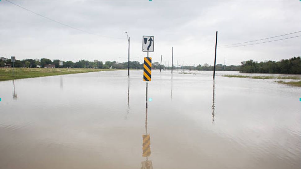
We recently wrote about this being the 20th Anniversary of “Turn Around, Don’t Drown,” a phrase birthed in Austin in 2004 to warn people of the hazards of walking or driving through floodwaters.
Specifically, the capital city lies close to the middle of what locals know as “Flash Flood Alley.” The alley extends from Dallas through Waco and Austin to San Antonio. It’s the Balcones Escarpment.
The escarpment is “a zone of faults” that geologically divides Texas. Faults occur when rocks break due to the forces acting on them.
The Escarpment separates the Edwards Plateau, the southeasternmost tip of the Great Plain from the Coastal Plains bordering the Gulf of Mexico. Our beautiful Hill Country lies just west of the escarpment.
All that noted, the question still confounds people as to why there is a higher threat of flooding here than just about anywhere else in the U.S.
For starters, storms take on rich supplies of moisture from both the Gulf of Mexico and the Pacific Ocean. Surface winds from the south and southeast often bring in copious amounts of moisture from the Gulf contributing to heavy rains. Upper-level winds bring in similar amounts of moisture from the Pacific. This is especially when hurricanes and tropical storms frolic through the far eastern Pacific.

The Hill Country, though west of the Balcones Escarpment, still lends to “the alley” by giving unstable air that extra lift that aids in storm development and higher intensity. The lift is the mechanism that releases that instability and is produced by fronts and low-pressure troughs.

No discussion about Flash Flood Alley would be complete without talking about the soil. Central Texas’ soil is rich in clay. And, the soil is shallow. Shallow soils do not allow much water to go deep into the grounds leading to potential flood problems.

Shallow soils extend less than ten inches before hitting ground that cannot be penetrated.
The clay soil limits the amount of water to sink into the ground. Thus, the water has to go somewhere, right?
The fourth and final reason for why we are in Flash Flood Alley has to do with all that expansion going on in the Austin area. All these buildings, all the developments take away the much-valued green spaces with pavements. Eating up that green space has been a big contributor to flash floods. I suppose it’s only a matter of time that more and more of that green space will be gone.

Now, you know. Always be careful when floods affect our area. It’s really important that you understand the power of water.