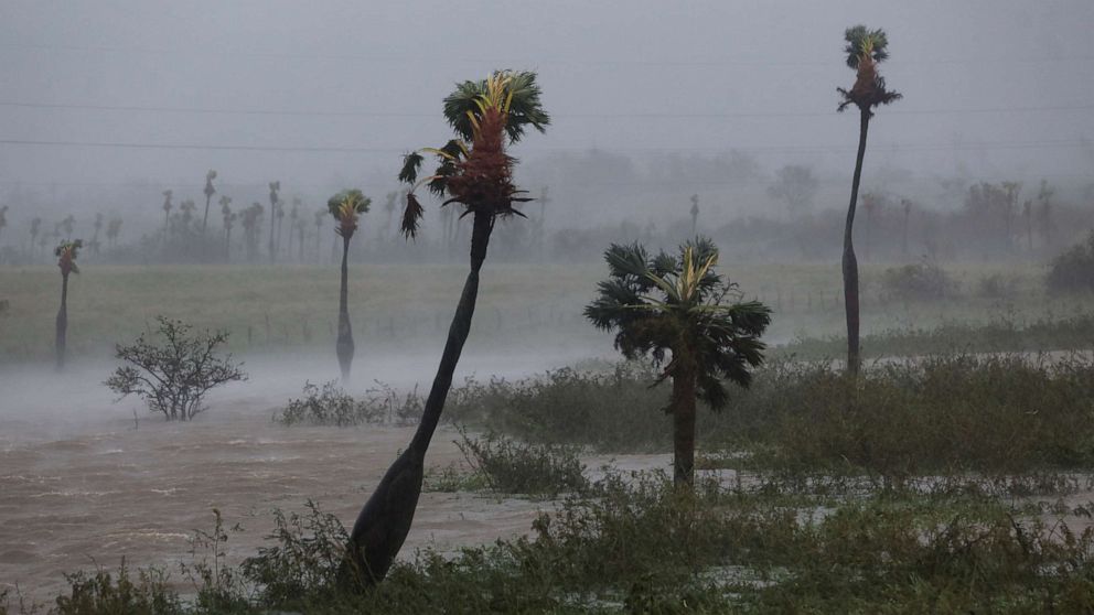
A major hurricane is targeting Florida, bringing with it the threat of high winds, dangerous storm surge and even tornadoes.
The position of Hurricane Ian as it enters Florida is shown in a satellite image graphic as of the evening of Sept. 27, 2022.
ABC News
Hurricane Ian, which is currently in the Gulf of Mexico, is forecast to make landfall on Florida’s western coast on Wednesday between 1 and 6 p.m., somewhere between Port Charlotte and Sarasota.
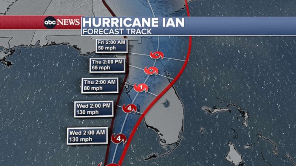
The storm could possibly approach Category 4 strength as it comes ashore — though track, timing and intensity could still change.
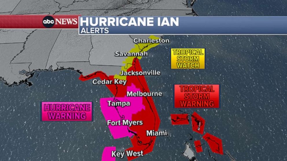
Significant and possibly devastating impacts could extend far from the center of the storm. The entire Florida peninsula is under either a hurricane or tropical storm warning. Hurricane warnings have been issued for Tampa and Fort Myers, extending south to Chokoloskee.
As Ian moves north, tropical storm force winds could reach coastal Georgia and South Carolina. Tropical storm watches have been issued for Savannah and near Charleston.
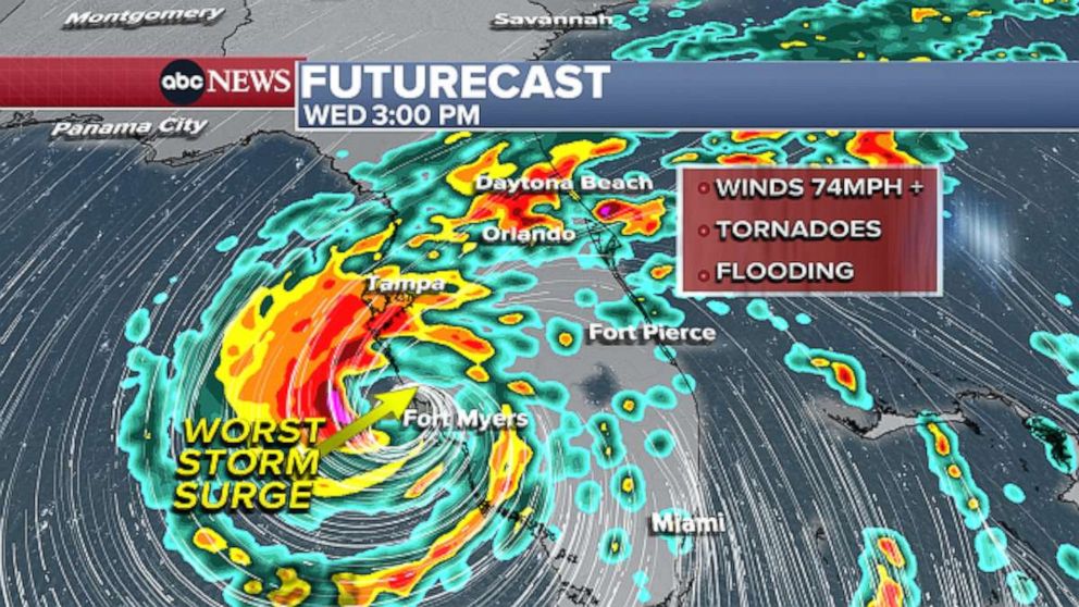
Life-threatening storm surge is possible, with up to 12 feet forecast in Fort Myers and up to 8 feet possible in Tampa. Jacksonville could also see up to 6 feet of storm surge. Storm surge warnings are in effect for a large portion of the west coast of Florida, from Cedar Key to the southwest corner of the state.
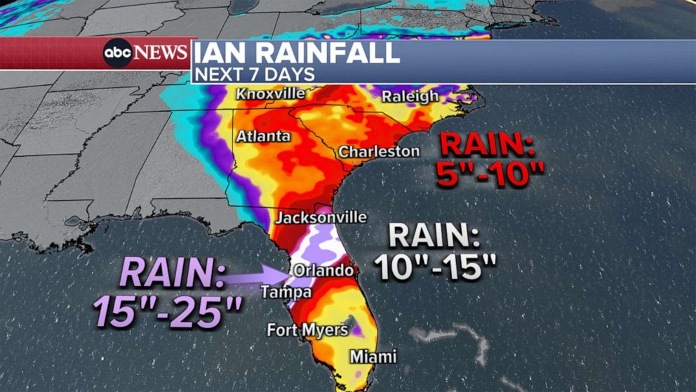
The projected 7 day rainfall estimates for Hurricane Ian as it travels into Florida is shown in a radar image graphic as of the afternoon of Sept. 27, 2022.
ABC News
Flooding from torrential rains is also possible inland. The highest rain totals are expected from Venice to Sarasota to the Tampa Bay area, where up to 20 inches of rain is forecast. Up to 2 feet is possible in some areas. Overall, a swath large of the Florida peninsula and up along the coast to South Carolina is forecast to get more than half a foot of rain through the upcoming weekend.
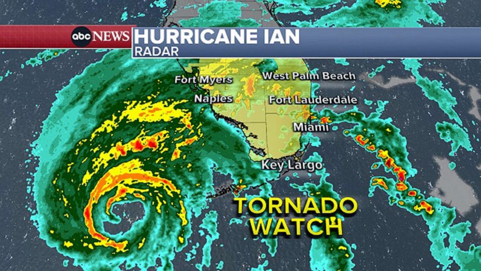
The areas under Tornado Watch for Hurricane Ian as it travels into Florida is shown in a radar image graphic as of the evening of Sept. 27, 2022.
ABC News
Tornadoes are possible over the next three days with Ian’s approach, as it makes landfall and moves north through Florida. At least three have been reported in South Florida so far Tuesday night. A tornado watch has been issued across South Florida through 5 a.m. Wednesday.