
The. U.S. National Hurricane Center in Miami said at 5 a.m. Wednesday that Ian now has top sustained winds of 140 mph and is centered about 75 miles west-southwest of Naples, Florida.
FDOT via AP
Joe Burbank/Orlando Sentinel via AP
Martha Asencia-Rhine/Tampa Bay Times via AP

AP Photo/Chris O’Meara
NOAA via AP
NOAA via AP

NOAA via AP
AP Photo/Wilfredo Lee
AP Photo/Wilfredo Lee
Dirk Shadd/Tampa Bay Times via AP

AP Photo/John Raoux
Dirk Shadd/Tampa Bay Times via AP
Douglas R. Clifford/Tampa Bay Times via AP
AP Photo/Wilfredo Lee

Joe Cavaretta/South Florida Sun-Sentinel via AP
AP Photo/Chris O’Meara
AP Photo/Chris O’Meara
AP Photo/Chris O’Meara
AP Photo/Chris O’Meara
Amy Beth Bennett/South Florida Sun-Sentinel via AP
AP Photo/Steve Helber
AP Photo/Steve Helber
AP Photo/Steve Helber
AP Photo/John Raoux

Joe Cavaretta/South Florida Sun-Sentinel via AP
AP Photo/Chris O’Meara
AP Photo/Chris O’Meara
AP Photo/Chris O’Meara
AP Photo/Ramon Espinosa
Stephen M. Dowell/Orlando Sentinel via AP
Amy Beth Bennett/South Florida Sun-Sentinel via AP
AP Photo/John Raoux
AP Photo/John Raoux
AP Photo/Steve Helber
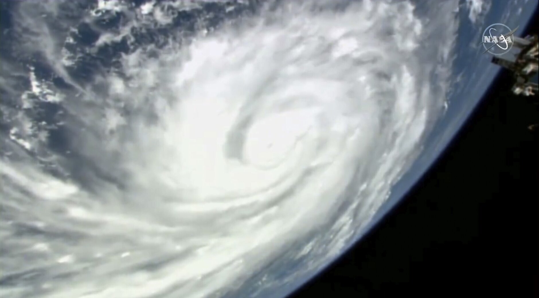
NASA via AP
Joe Burbank/Orlando Sentinel via AP

Stephen M. Dowell/Orlando Sentinel via AP
AP Photo/Mary Martin
NOAA via AP
Joe Cavaretta/South Florida Sun-Sentinel via AP
Joe Cavaretta/South Florida Sun-Sentinel via AP
Joe Cavaretta/South Florida Sun-Sentinel via AP
NASA via AP
NASA via AP
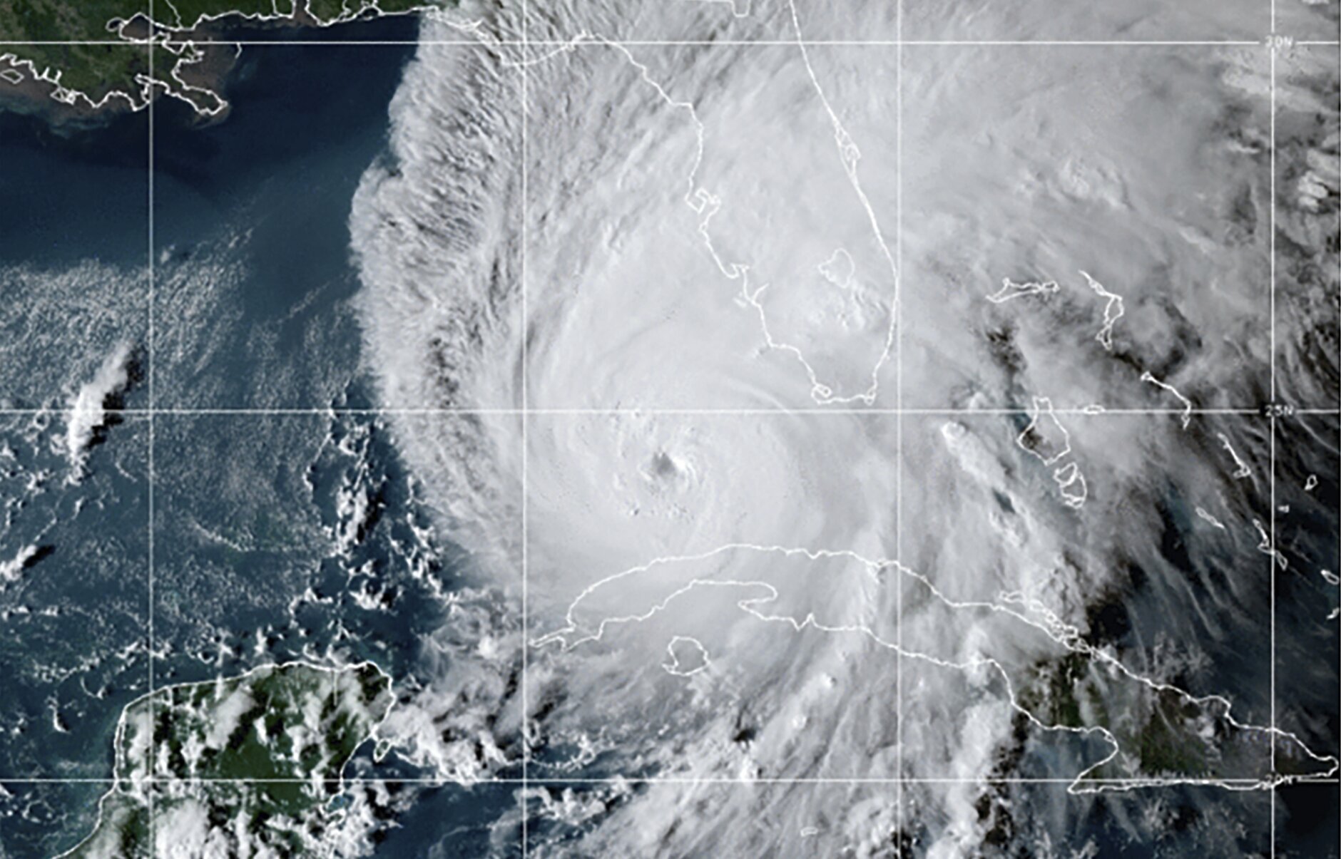
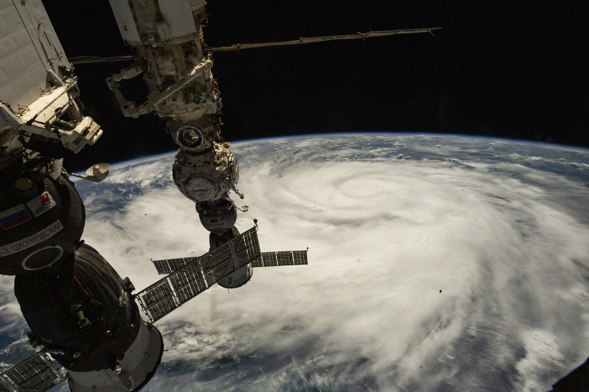
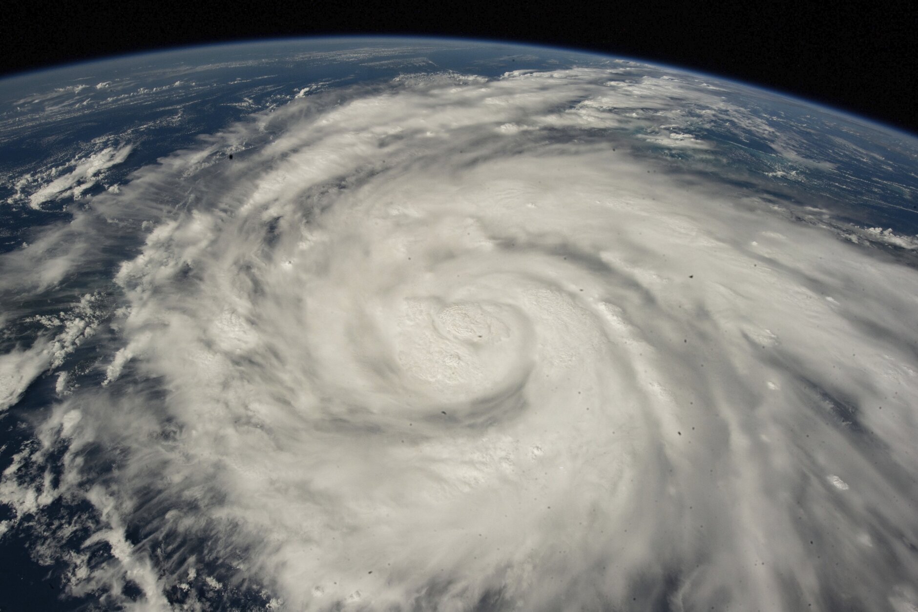
ST. PETERSBURG, Fla., (AP) — Hurricane Ian’s most damaging winds began hitting Florida’s southwest coast Wednesday, lashing the state with heavy rain and pushing a devastating storm surge after strengthening to the threshold of the most dangerous Category 5 status.
Fueled by warm waters in the Gulf of Mexico, Ian grew to a catastrophic Category 4 hurricane overnight with top winds of 155 mph (250 kph), according to the National Hurricane Center. The storm trudged on a track that would have it making landfall north of the heavily populated Fort Myers area, which forecasters said could be inundated by a storm surge of up to 18 feet (5.5 meters).
“This is going to be a nasty nasty day, two days,” Florida Gov. Ron DeSantis said, stressing that people in Ian’s path along the coast should rush to the safest possible shelter and stay there.
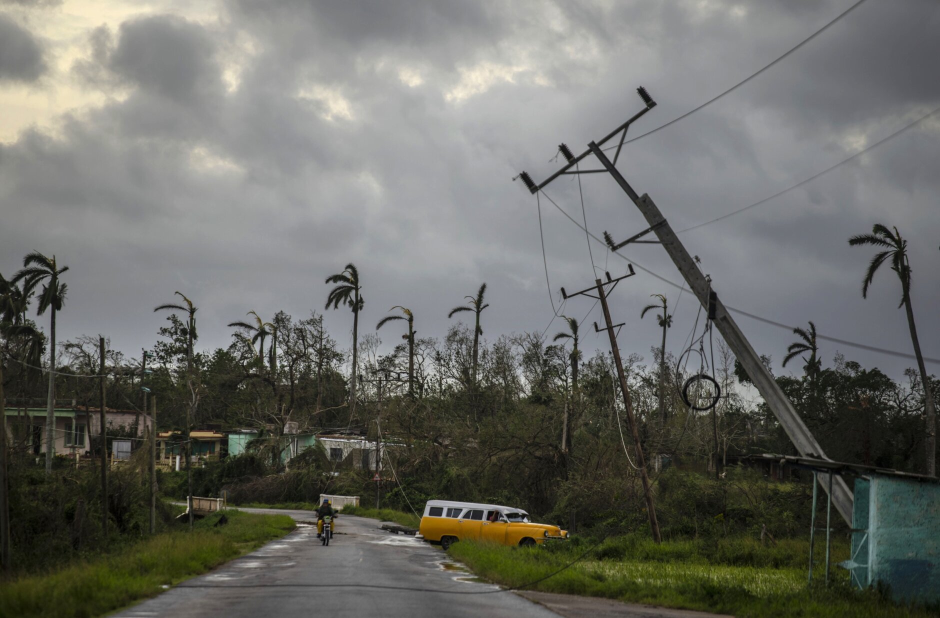
Ian menaced Florida after bringing destruction Tuesday to western Cuba, where two people were reported dead and the storm brought down the country’s electrical grid.
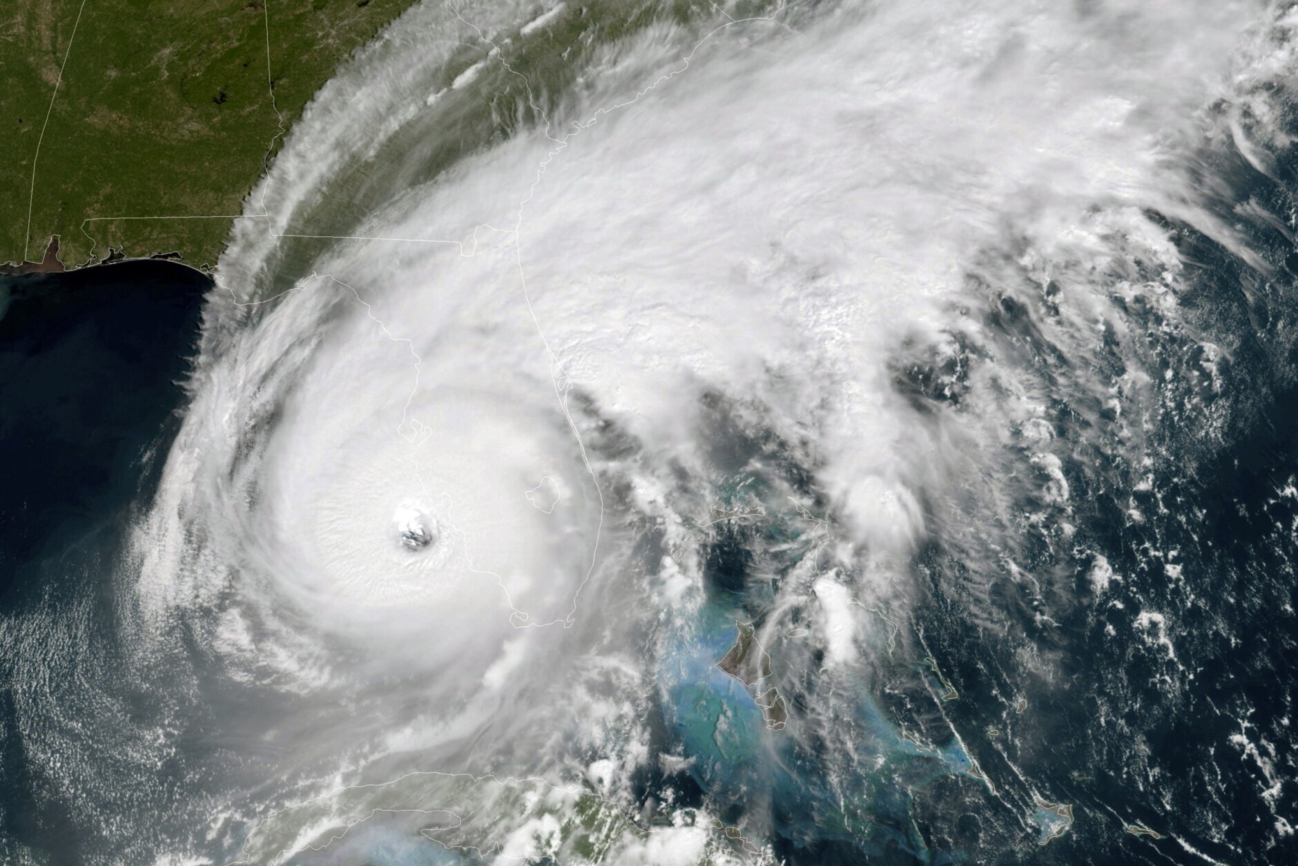
Ian’s center was about 35 miles (56 kilometers) west of Fort Myers at 1 p.m. Wednesday, as it churned toward toward the coast at 9 mph (15 kph). Ian’s plodding pace meant the storm was expected to spend a day or more crawling across the Florida peninsula, dumping flooding rains of 12 to 18 inches (30 to 45 centimeters) across a broad area including Tampa, Orlando and Jacksonville in the state’s northeast corner.
Catastrophic storm surges could push 12 feet (3.6 meters) of water or more across more than 250 miles (400 kilometers) of coastline, from Bonita Beach to Englewood, the hurricane center warned.
“It’s going to get a lot worse very quickly. So please hunker down,” DeSantis said.
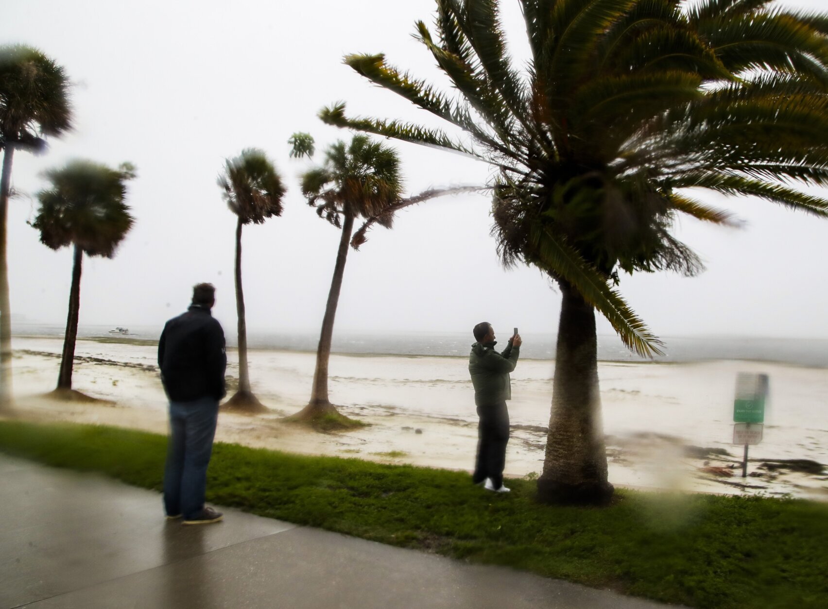
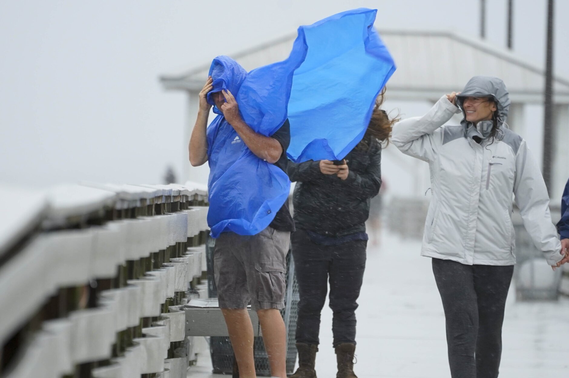
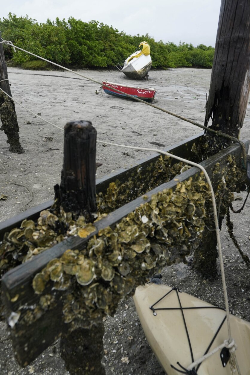
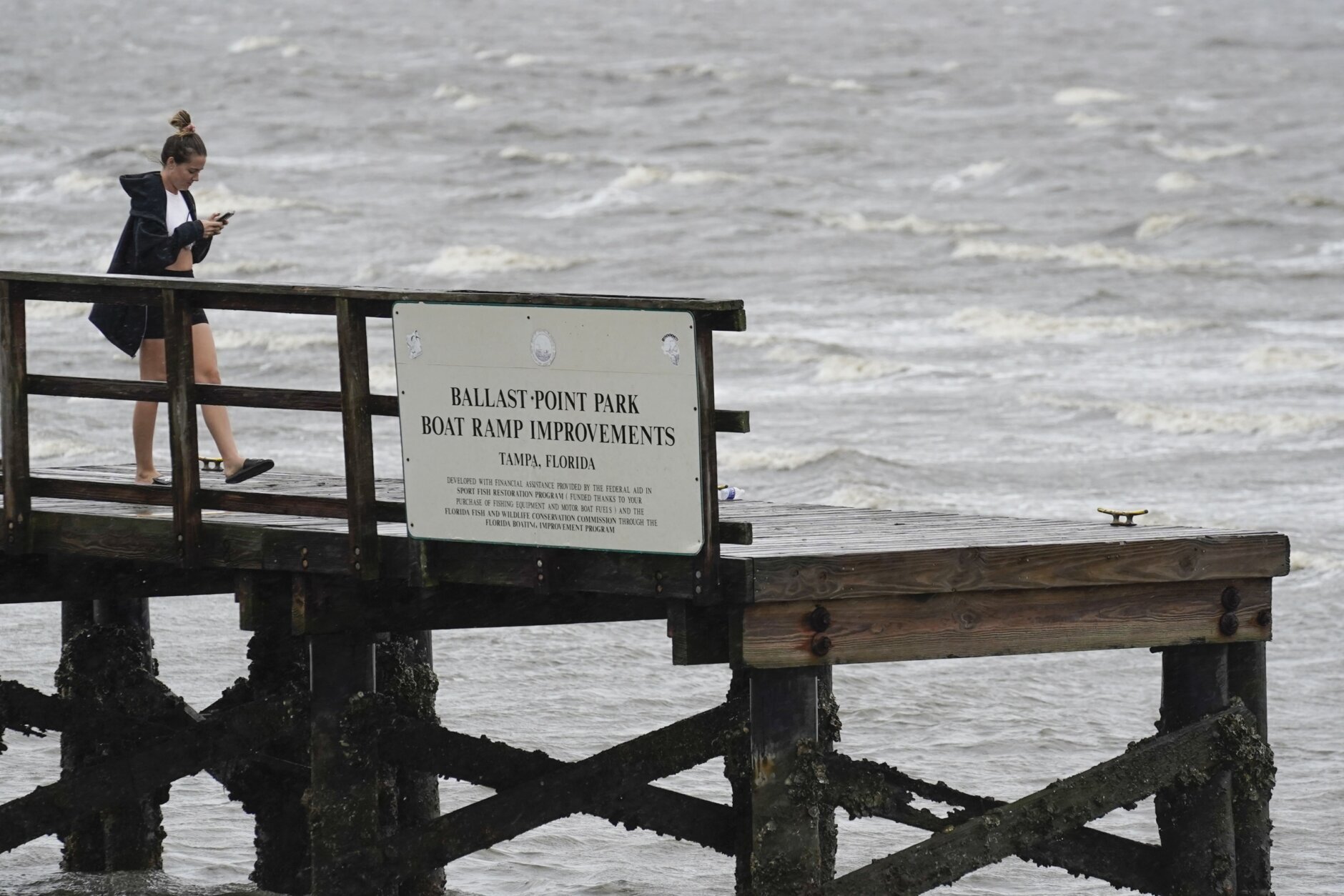
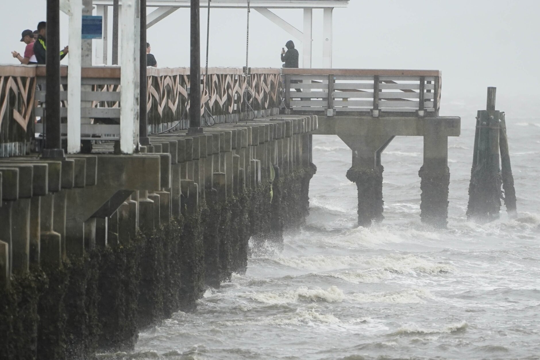
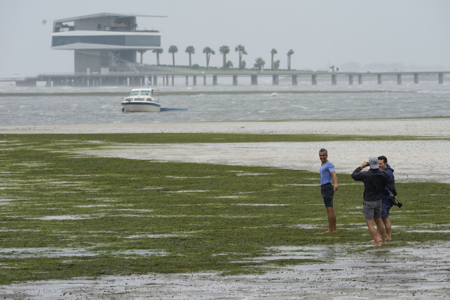
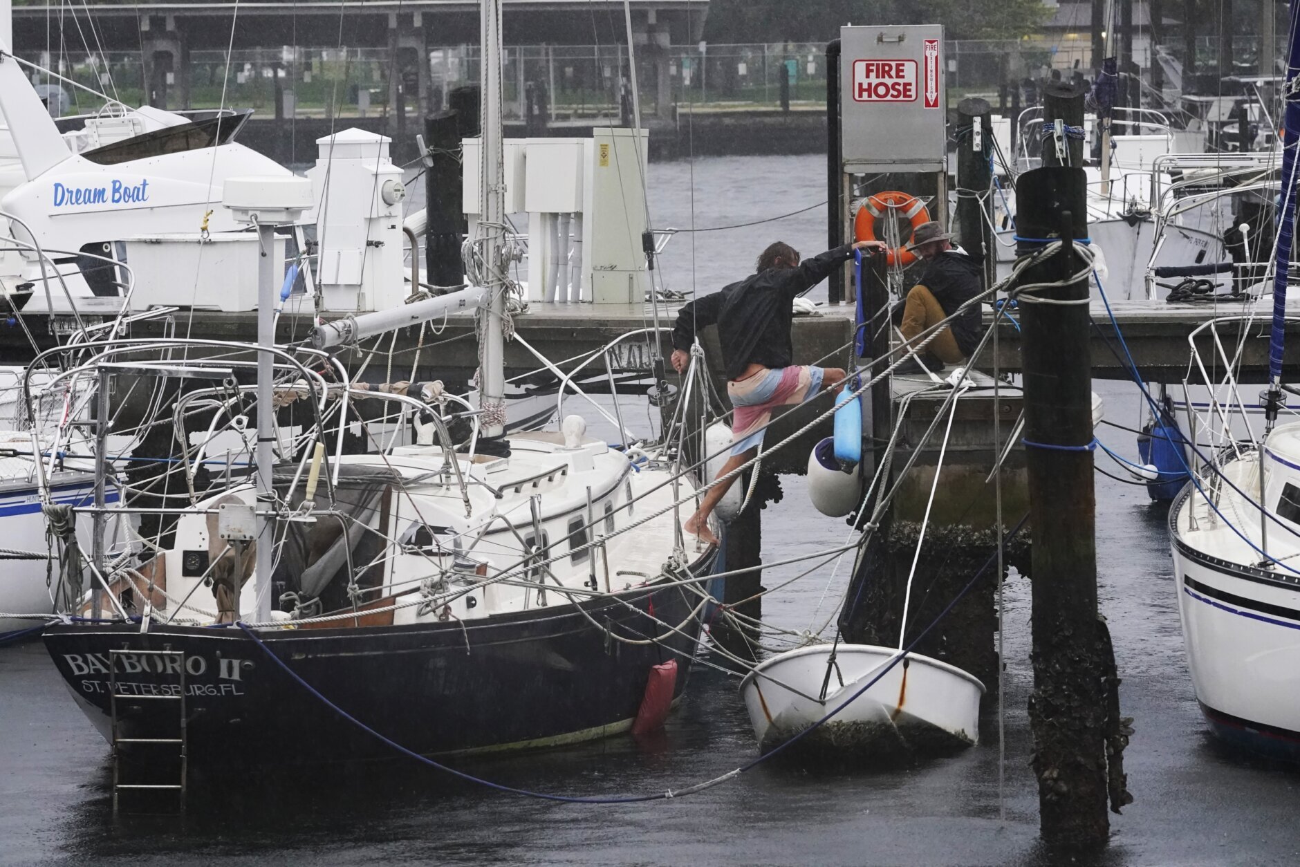
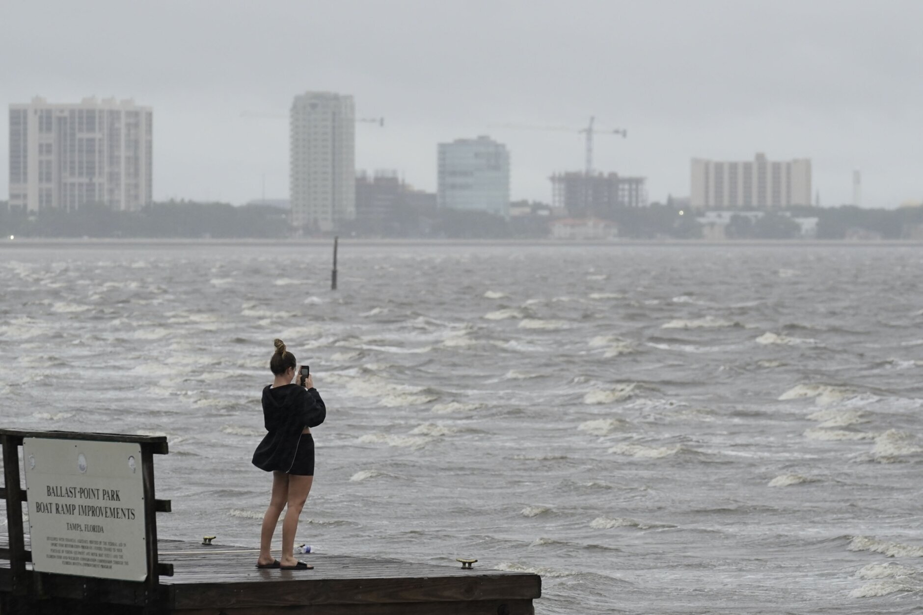
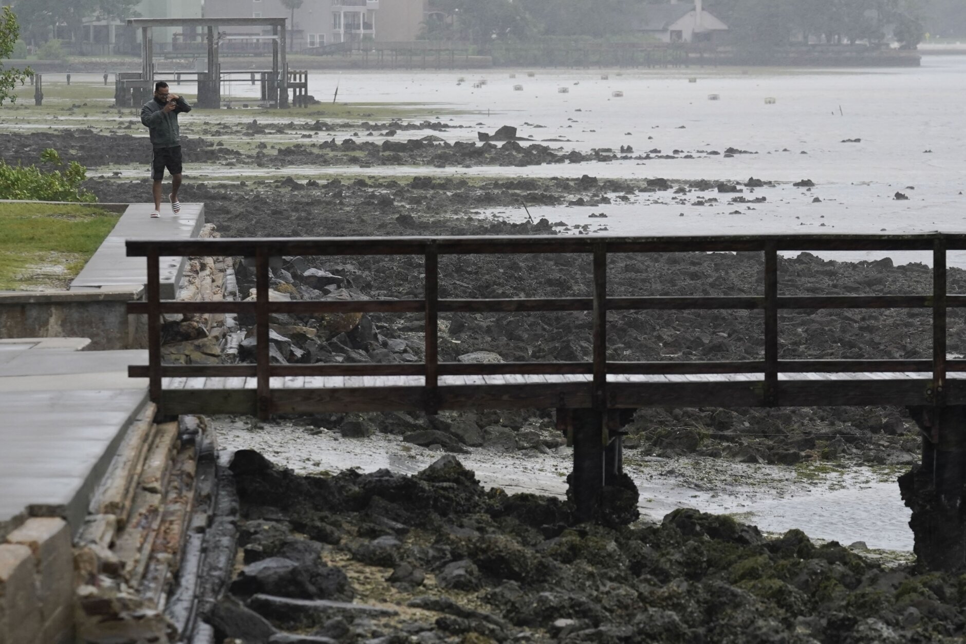
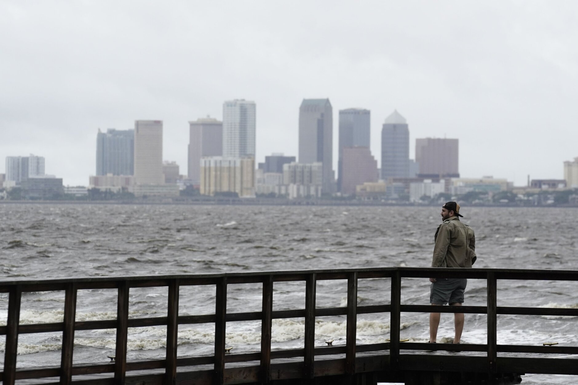
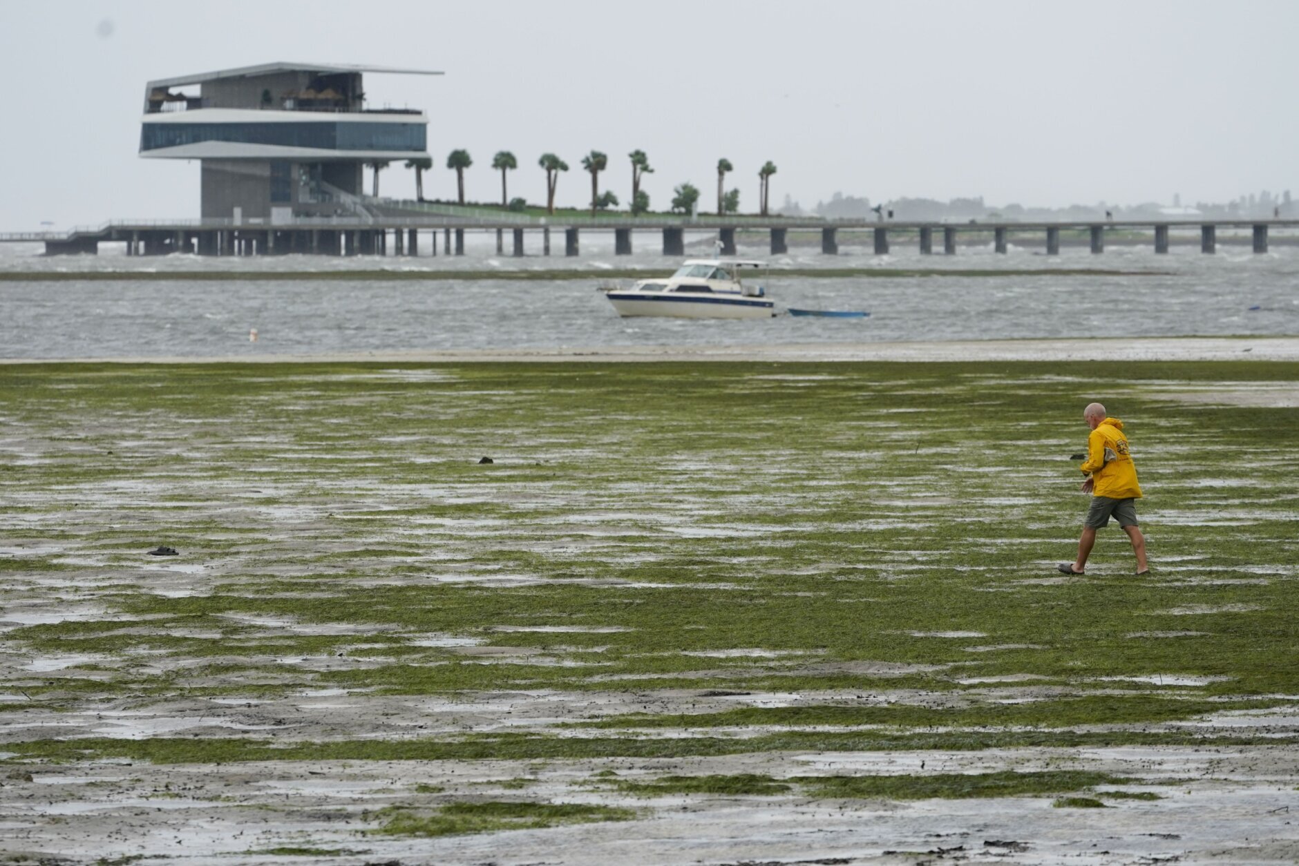
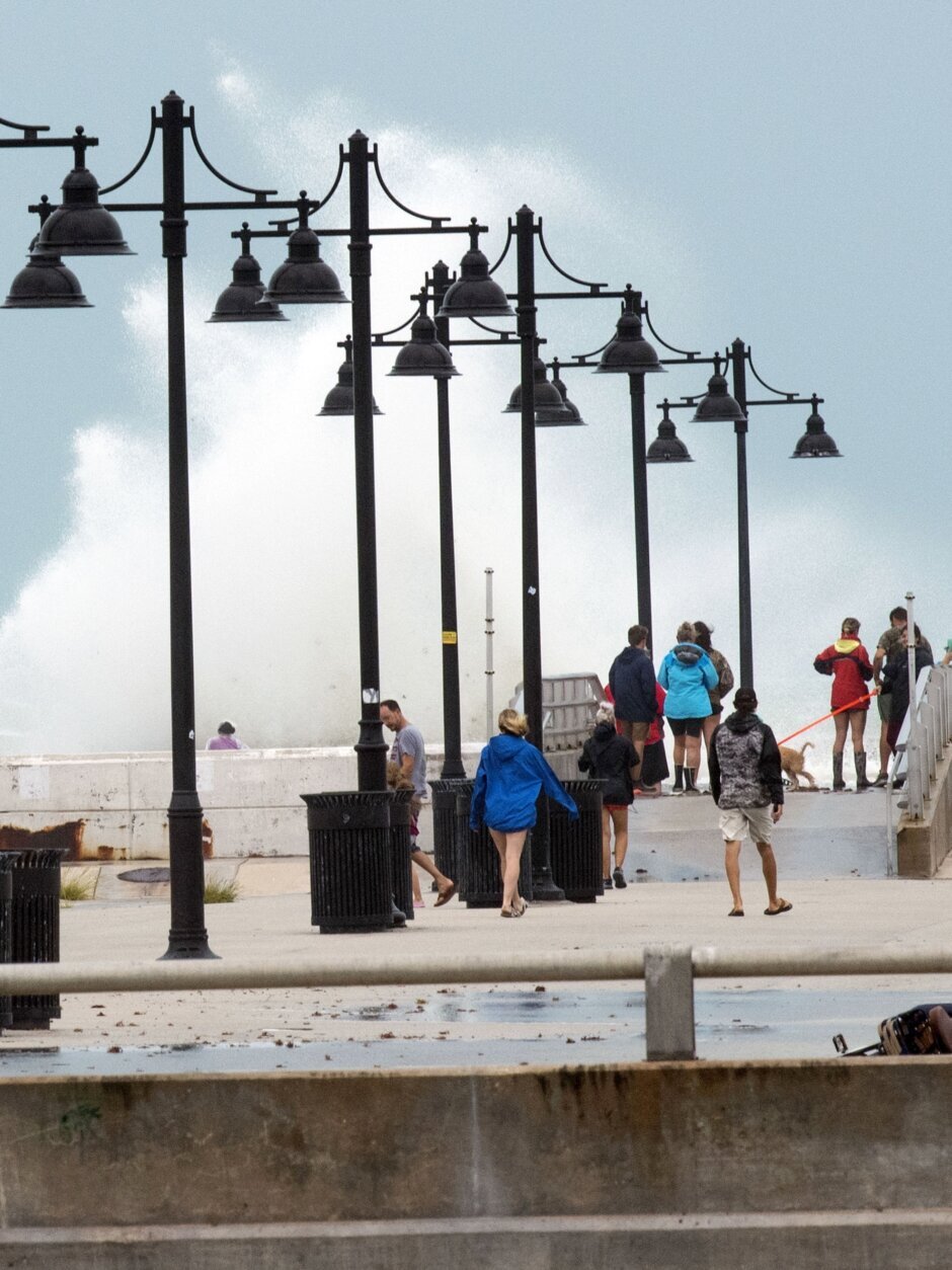
Off the coast on Sanibel Island near Fort Myers, swirling water covered residential streets and was halfway up mailbox posts by mid-morning. Seawater rushed out of Tampa Bay, leaving parts of the muddy bottom exposed, and waves crashed over the end of a wooden pier at Naples.
Ian’s rapid strengthening caused Fort Myers handyman Tom Hawver to abandon his plan to weather the hurricane at home and head across the state to Fort Lauderdale.
“We were going to stay and then just decided when we got up, and they said 155 mph winds,” Hawver said. “We don’t have a generator. I just don’t see the advantage of sitting there in the dark, in a hot house, watching water come in your house.”
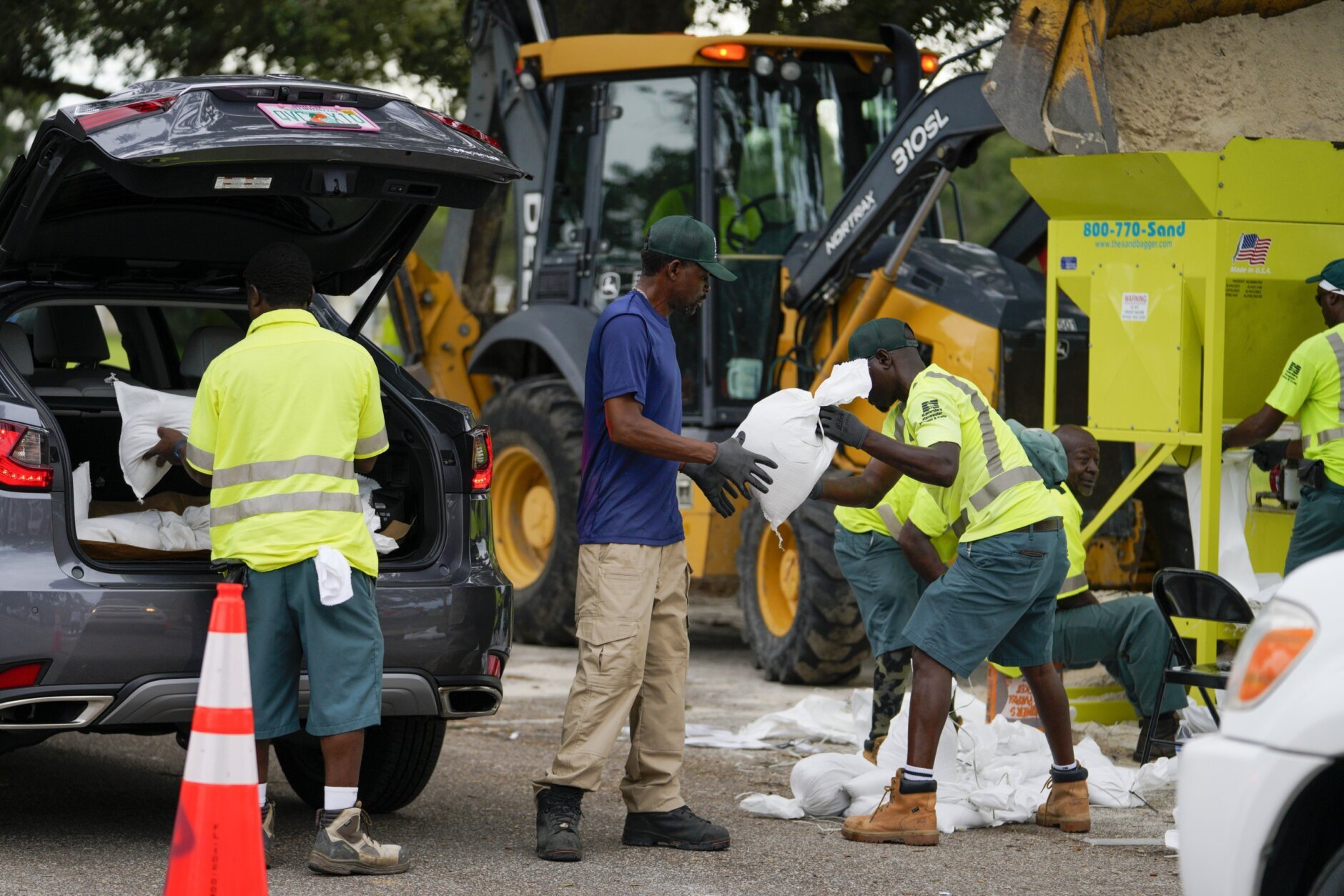
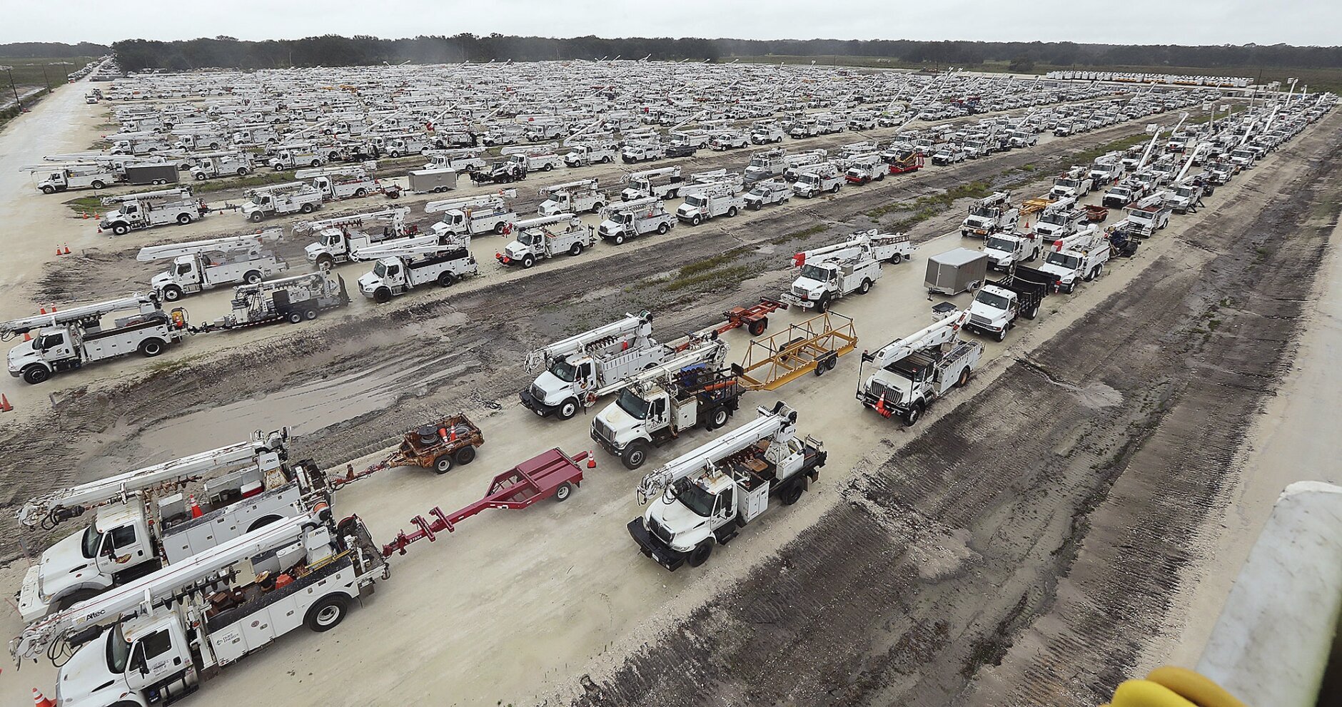
More than 2.5 million people were under mandatory evacuation orders, but by law no one could be forced to flee. The governor said the state has 30,000 linemen, urban search and rescue teams, and 7,000 National Guard troops from Florida and elsewhere ready to help once the weather clears.
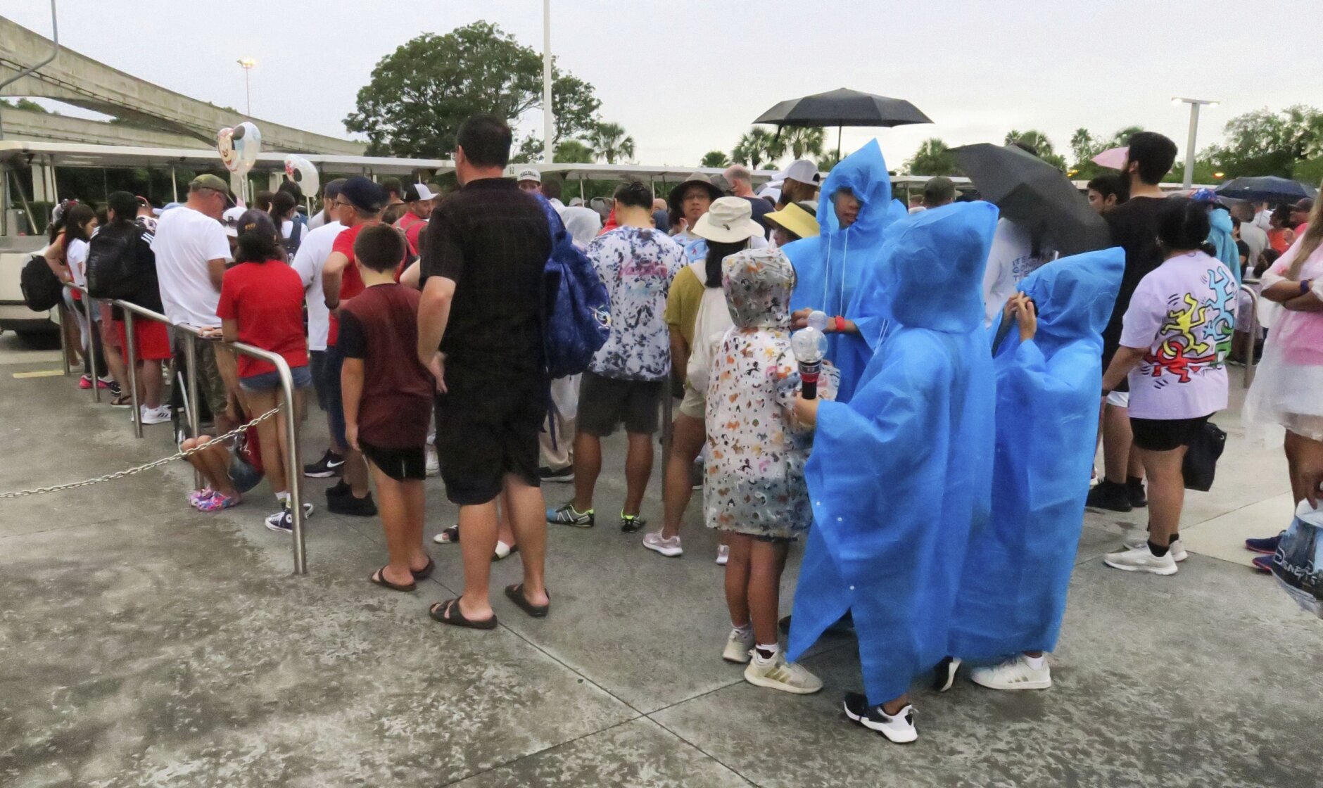
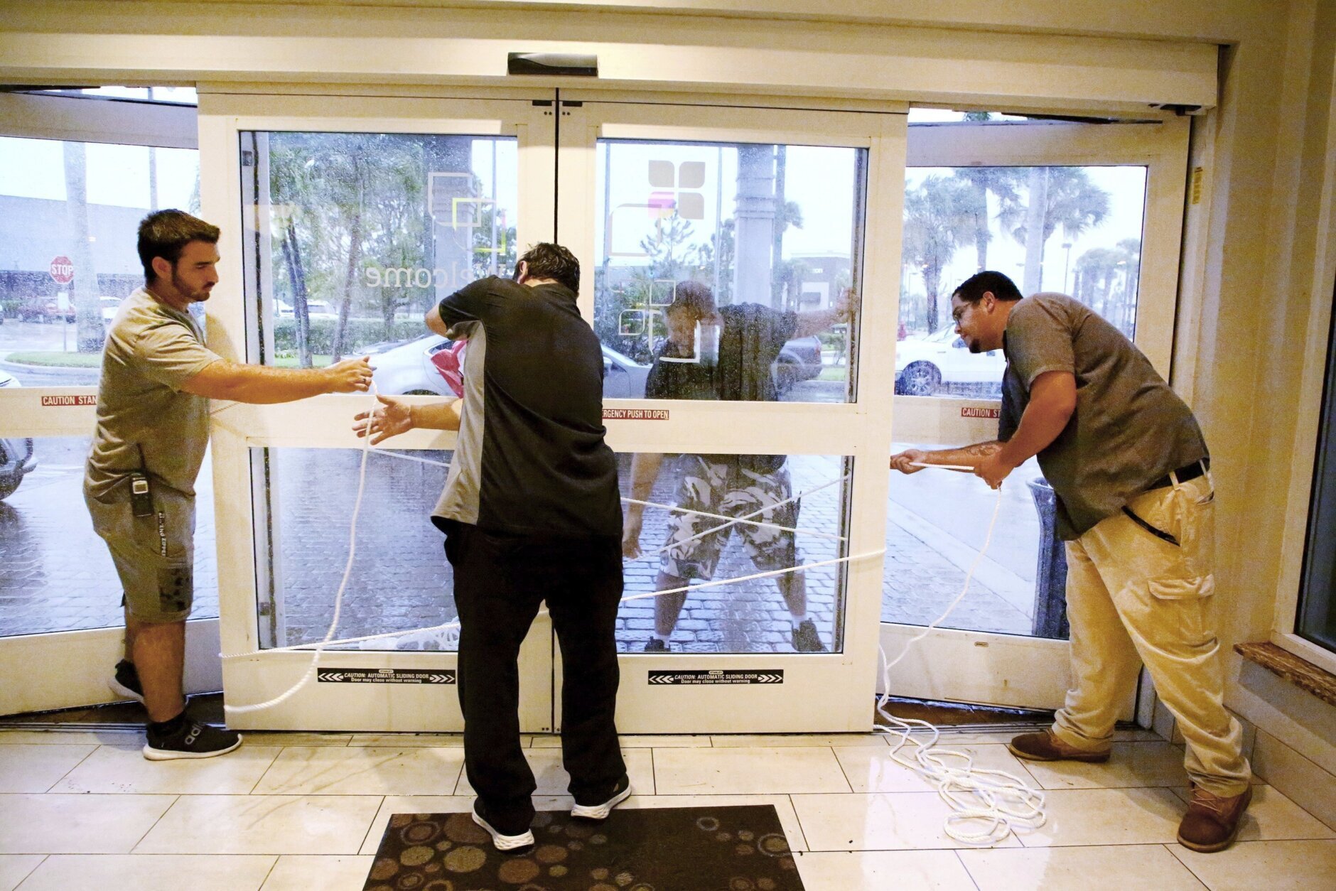
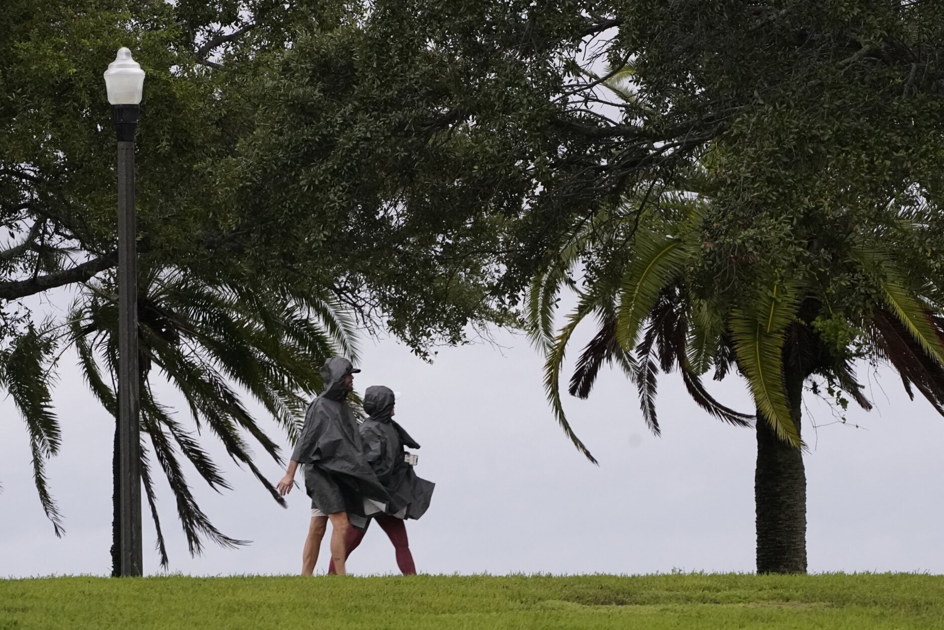
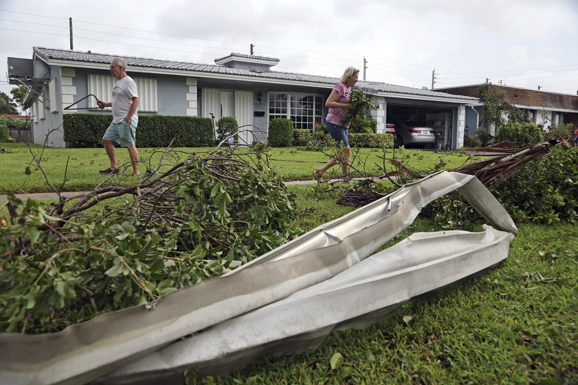
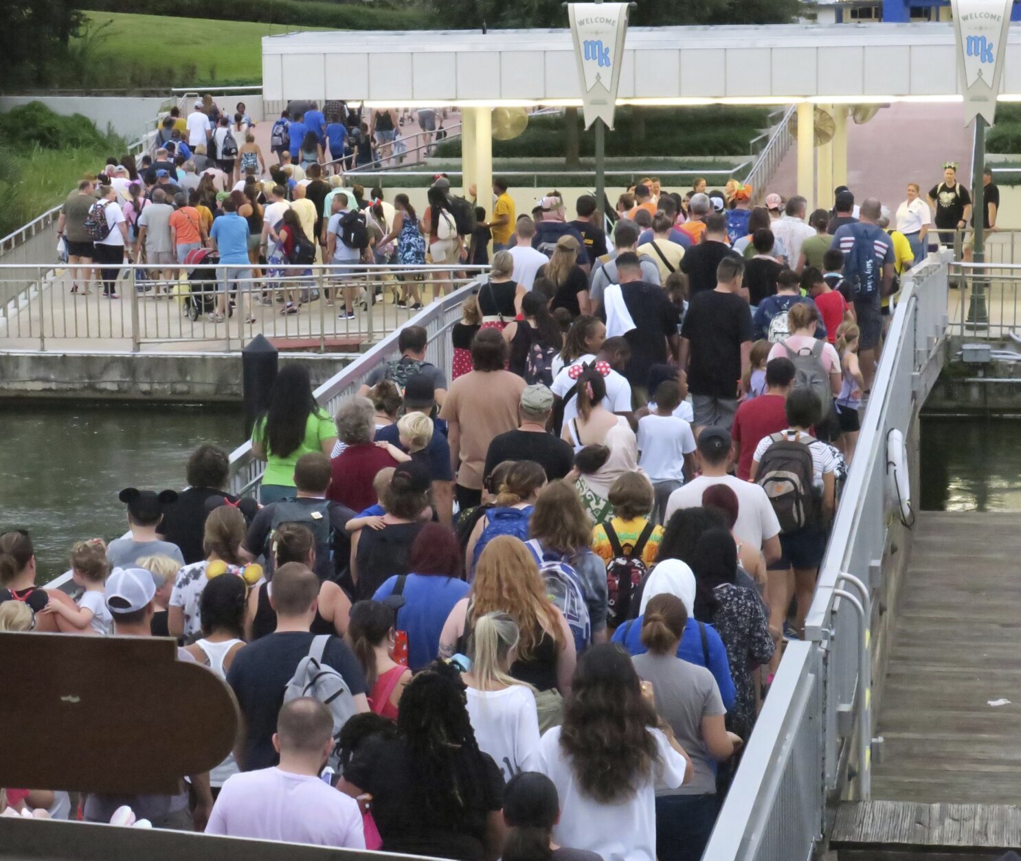
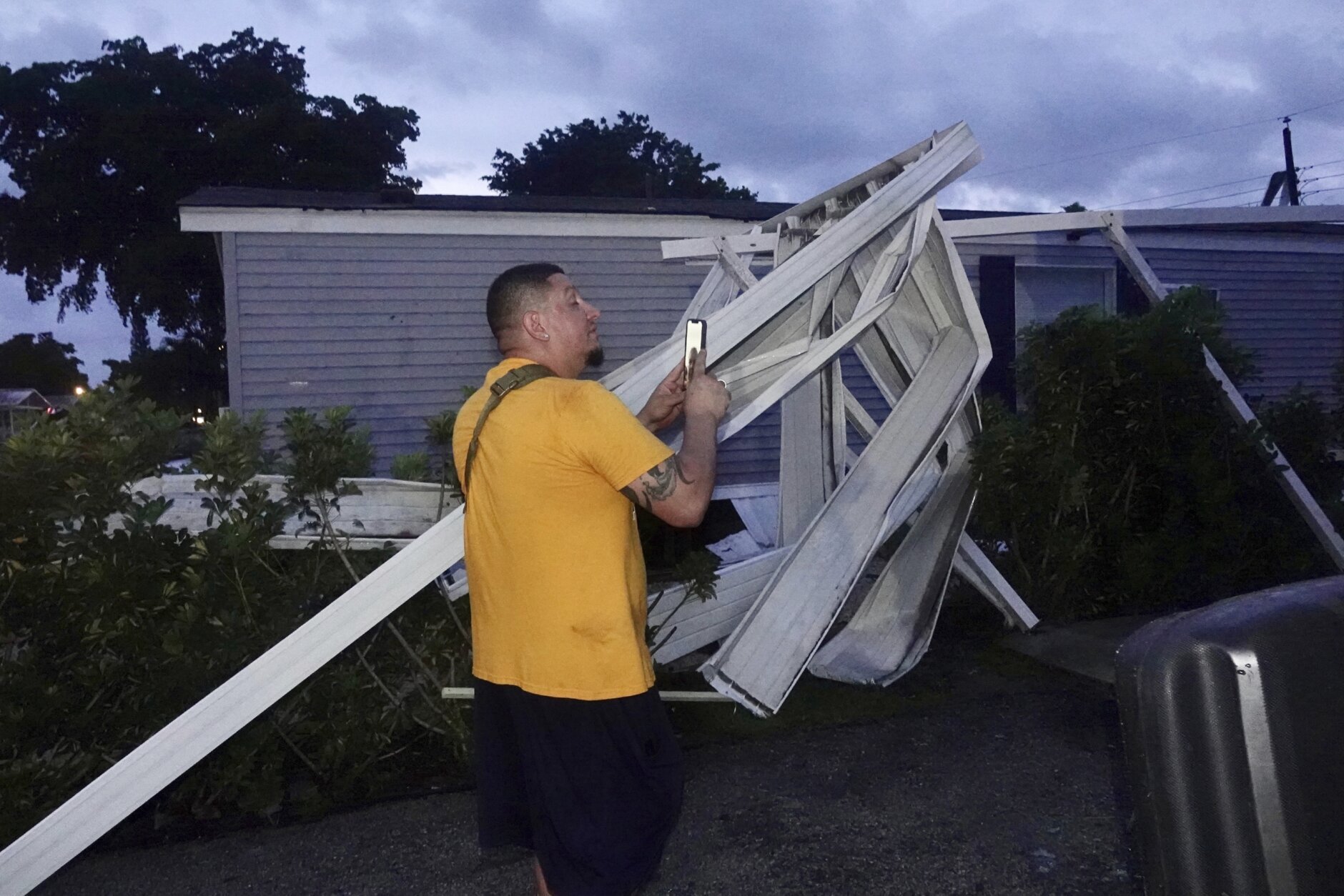
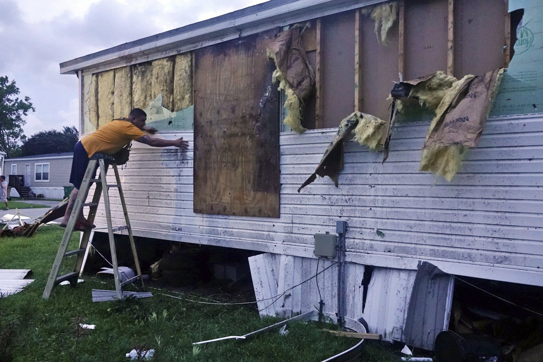
Florida residents rushed ahead of the impact to board up their homes, stash precious belongings on upper floors and join long lines of cars leaving the shore.
Some chose to stay and ride out the storm. Jared Lewis, a Tampa delivery driver, said his home has withstood hurricanes in the past, though not as powerful as Ian.
“It is kind of scary, makes you a bit anxious,” Lewis said. “After the last year of not having any, now you go to a Category 4 or 5. We are more used to the 2s and 3s.”
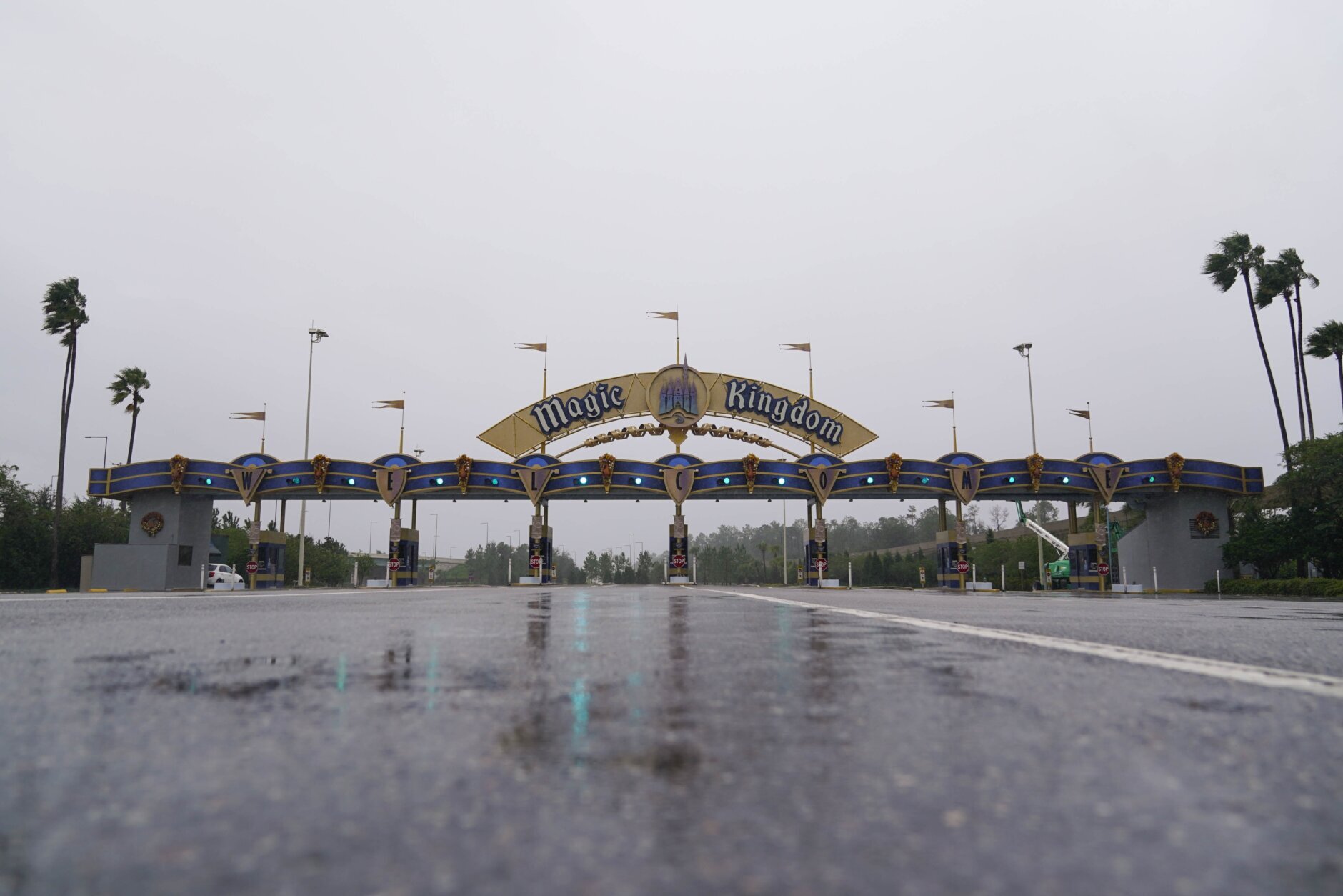
Forecasters predicted Ian would make landfall more than 100 miles (160 kilometers) south of Tampa and St. Petersberg, likely sparing the densely populated Tampa Bay area from its first direct hit by a major hurricane since 1921.
Officials warned residents that Tampa could still experience powerful winds and up to 20 inches (50 centimeters) of rain.
“Please, please, please be aware that we are not out of danger yet,” Tampa Mayor Jane Castor said in a video on Twitter. “Flooding is still going to occur.”
During the night, Ian went through a natural cycle when it lost its old eye and formed a new one. The timing was bad for the Florida coast, because the storm got stronger and larger — 120 mph (193 kph) to 155 mph (250 kph) — with landfall just a few hours away.
The size of the storm also grew, with tropical storm force winds extending 175 miles (280 kilometers) from the hurricane’s center.
“With the higher intensity you’re going to see more extensive wind damage,” University of Miami hurricane researcher Brian McNoldy said. “The larger wind field means that more people will experience those storm-force winds.”
The most damaging winds could hit a coastline where the population has jumped sevenfold since 1970, according to the U.S. Census.
Ash Dugney warily watched ocean water being sucked out below a Tampa Bay pier Wednesday morning. He said he didn’t trust Tampa’s storm drainage system to keep his corner tuxedo rental business safe from flooding that he said has happened even during mild storms.
“I don’t care about the wind and the rain and the stuff like that, I just care about the flooding,” Dugney said, adding that he moved essentials out of the shop and moved other items up to above waist-high level.
Flash floods were possible across all of Florida. Hazards include the polluted leftovers of Florida’s phosphate fertilizer mining industry, more than 1 billion tons of slightly radioactive waste contained in enormous ponds that could overflow in heavy rains.
Forecasters placed roughly 120 miles (193 kilometers) of central Florida’s east coast under a hurricane warning Wednesday, signaling that Ian may remain a hurricane longer than previously expected as it moves inland.
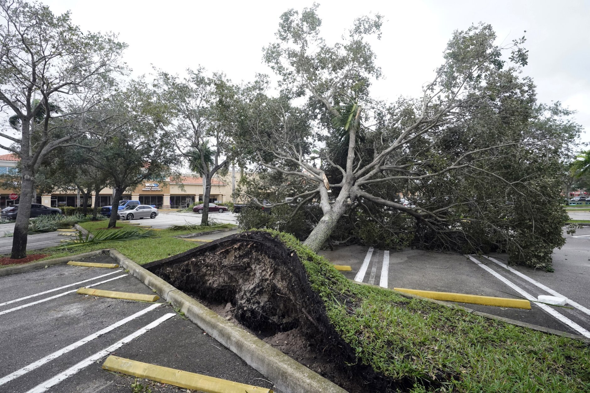
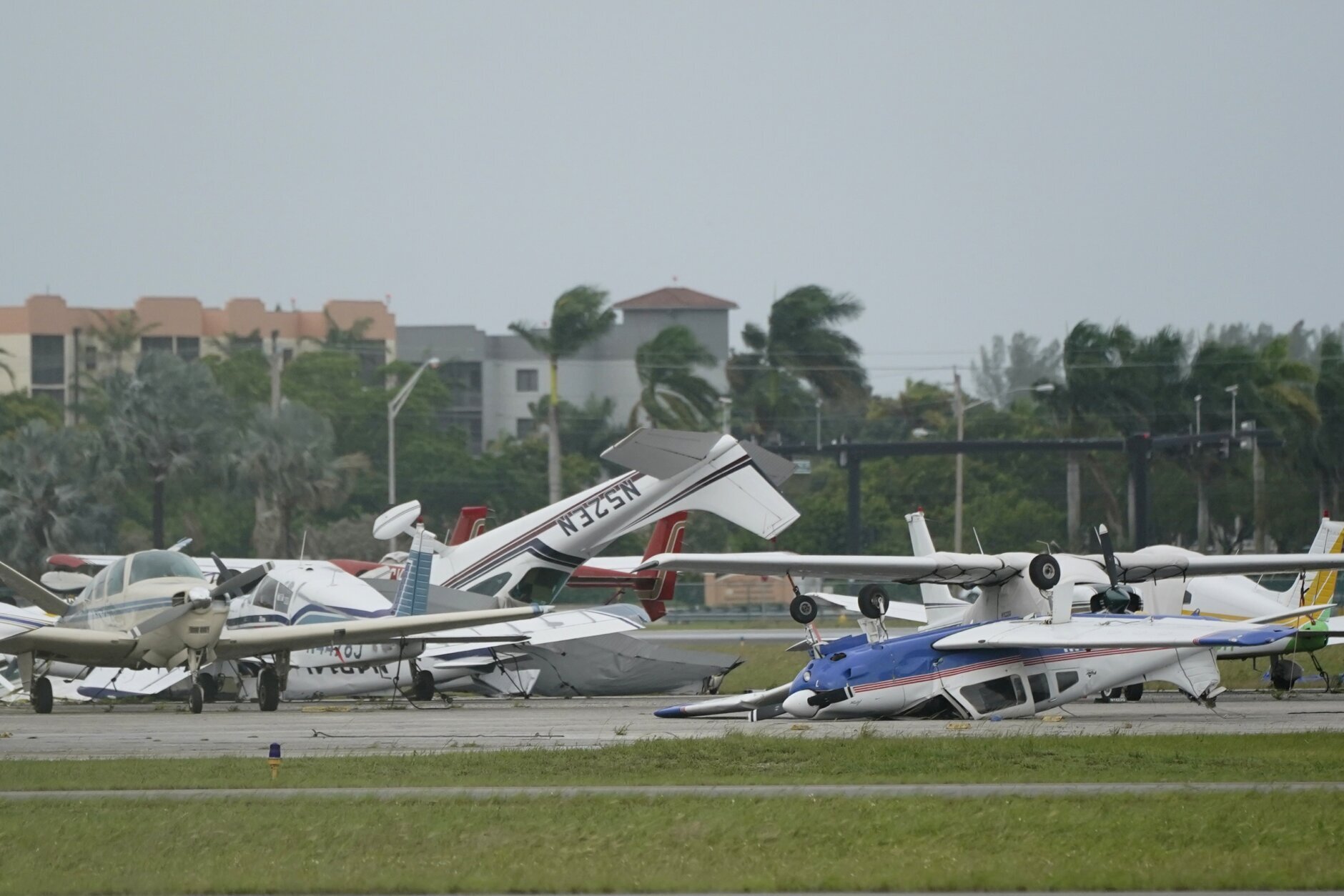
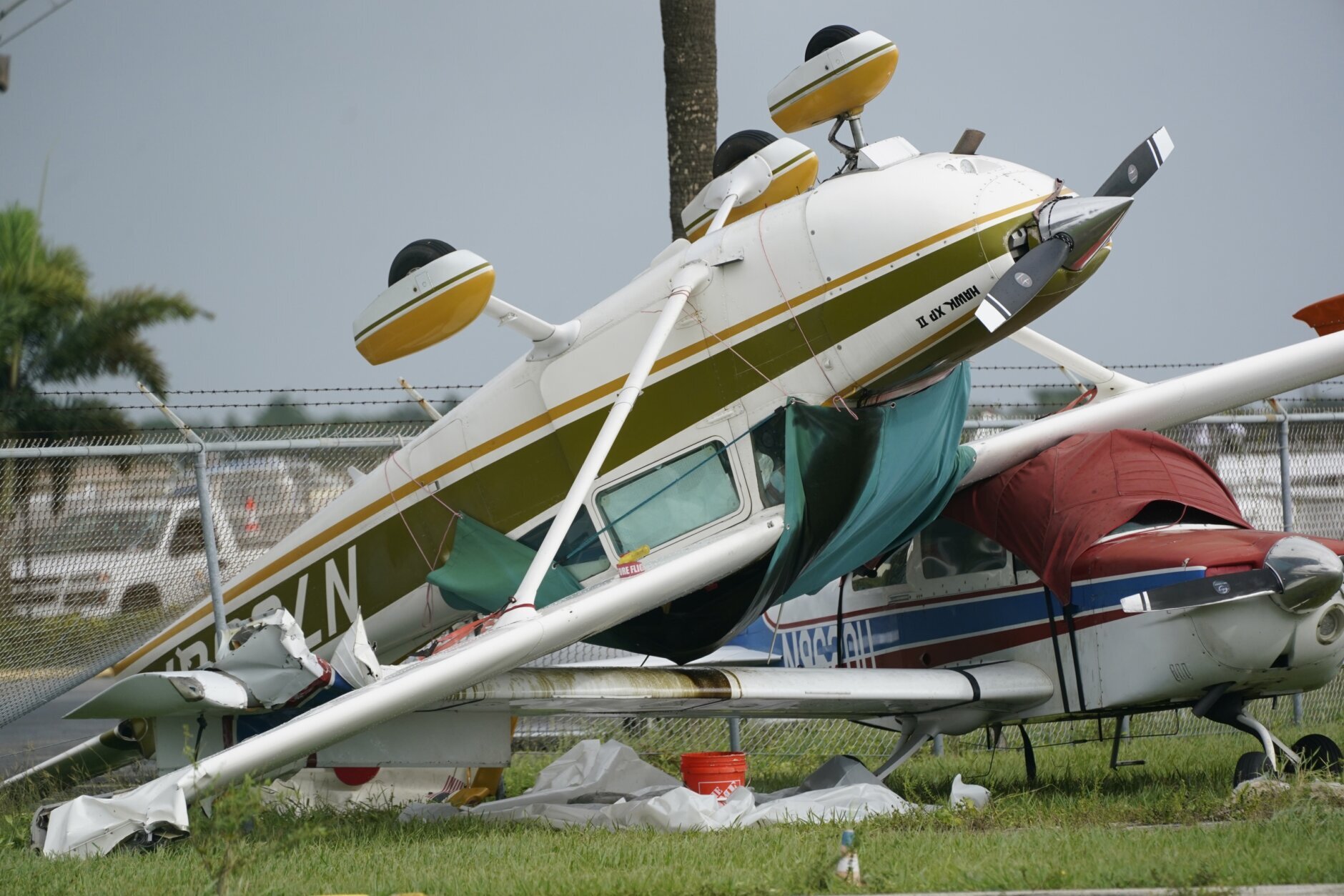
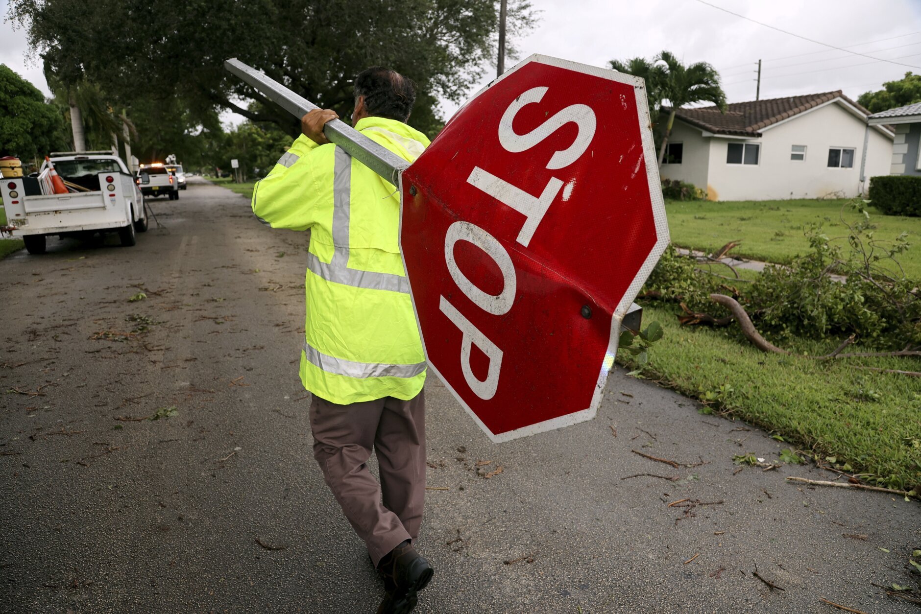
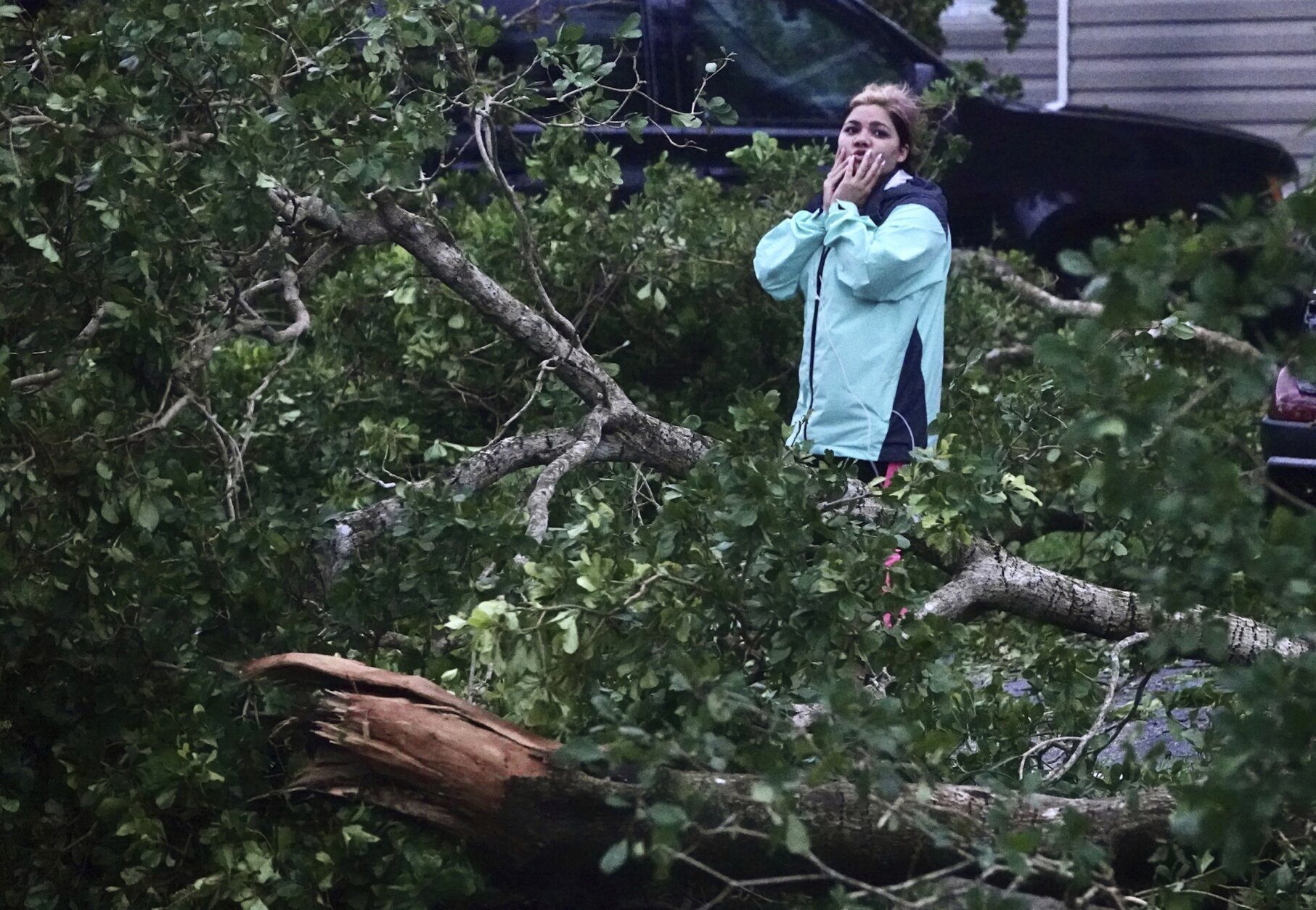
Isolated tornadoes were spinning off the storm well ahead of landfall. One tornado damaged small planes and a hangar at the North Perry Airport, west of Hollywood along the Atlantic coast.
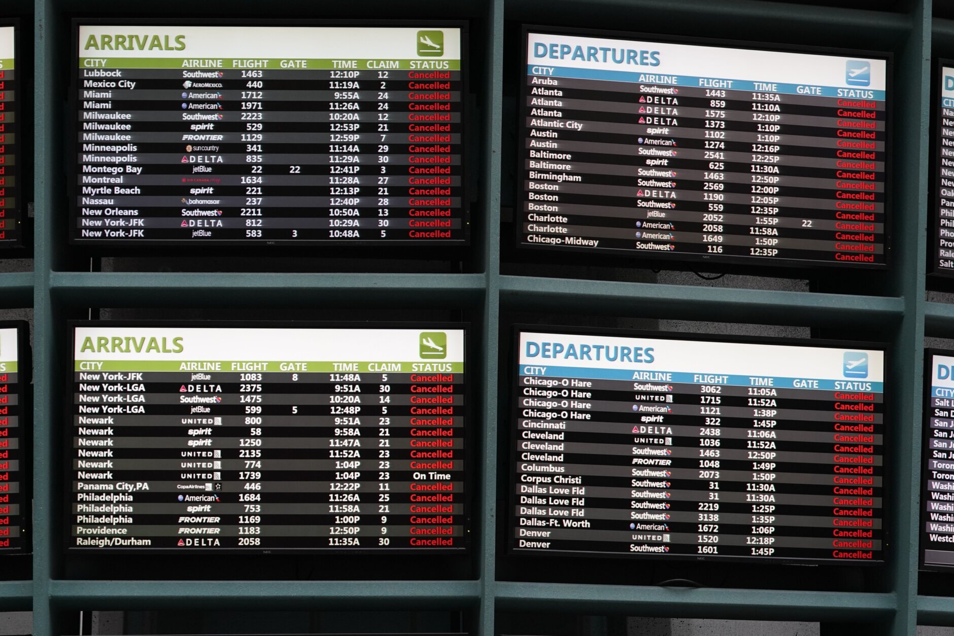
More than 450,000 homes and businesses were without electricity, and Florida Power and Light warned those in Ian’s path to brace for days without power.
The federal government sent 300 ambulances with medical teams and was ready to truck in 3.7 million meals and 3.5 million liters of water once the storm passes.
“We’ll be there to help you clean up and rebuild, to help Florida get moving again,” President Joe Biden said Wednesday. “And we’ll be there every step of the way. That’s my absolute commitment to the people of the state of Florida.”
Parts of Georgia and South Carolina also could see flooding rains and some coastal surge into Saturday. Georgia Gov. Brian Kemp preemptively declared an emergency, ordering 500 National Guard troops onto standby.
___
Associated Press contributors include Christina Mesquita in Havana, Cuba; Cody Jackson and Adriana Gomez Licon in Tampa, Florida; Freida Frisaro in Miami; Anthony Izaguirre in Tallahassee, Florida; Mike Schneider in Orlando, Florida; Seth Borenstein and Aamer Madhani in Washington; Bobby Caina Calvan in New York; Andrew Welsh-Huggins in Columbus, Ohio; and Jay Reeves in Birmingham, Alabama.
Copyright
© 2022 The Associated Press. All rights reserved. This material may not be published, broadcast, written or redistributed.