Weather
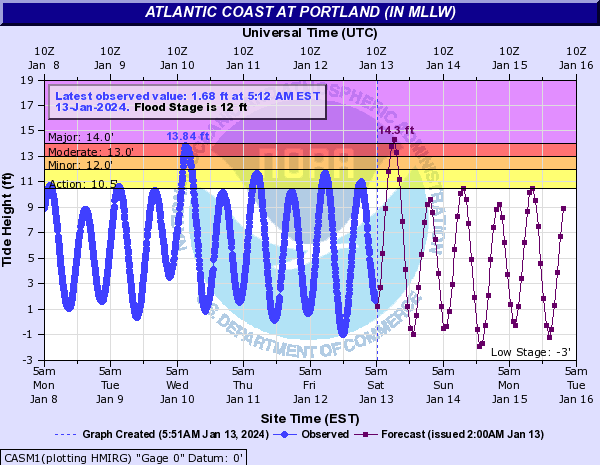
There’s a coastal flood warning for the entire coast of Rhode Island and Massachusetts up to Maine.
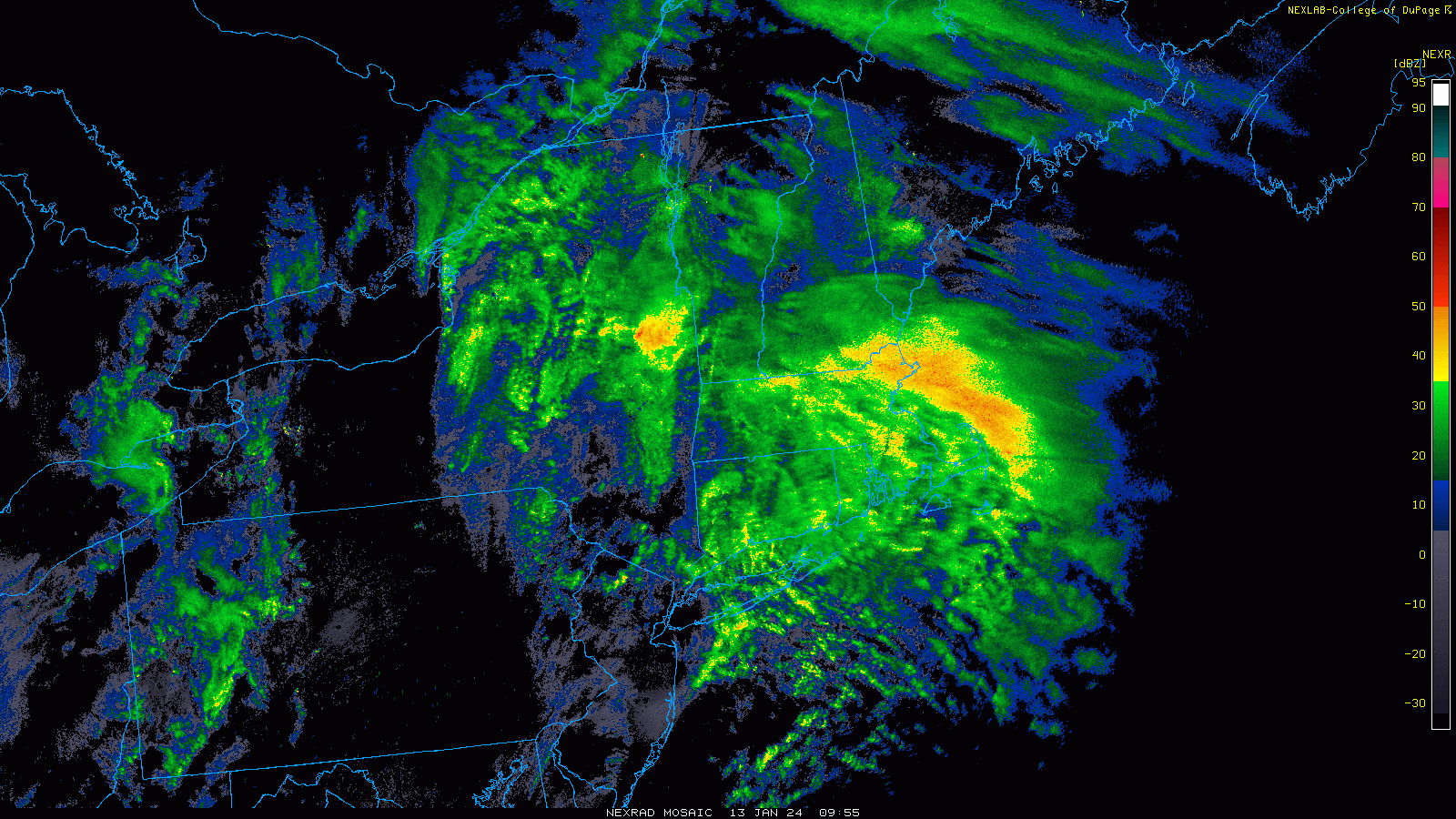
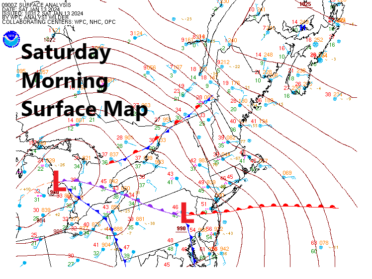
More rain was pelting against the windows early this morning as a new storm system impacted New England. The storm is bringing gusty winds, heavy rain along with river, stream, basement and some coastal flooding.
There’s a coastal flood warning for the entire coast of Rhode Island and Massachusetts up to Maine. Some locals in New Hampshire and Maine are forecast to see some of the highest water levels on record. Although water levels will be higher, the wave action will not be as bad as in some severe nor’easters or other storms. The damage, therefore, will not be as extensive as the Blizzard of ‘78 or the Perfect Storm in 1991, even though the water level itself will be higher.
Closer to home, our rivers and streams are running really high. This has resulted in flood warnings being issued.
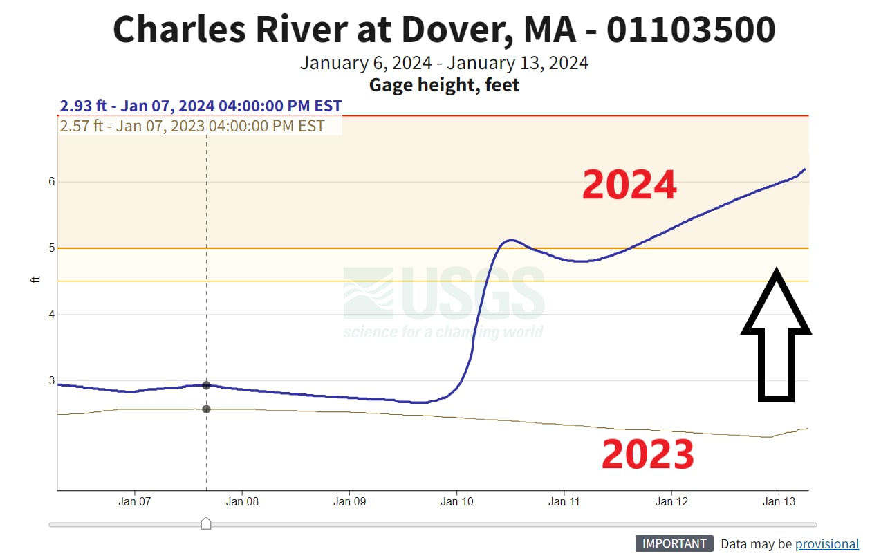
I took a look at just one river gauge in Dover, of the Charles River. You can see the peak that happened back on Wednesday during that storm and that the water never really receded, and now we’re going up from there. This is why our rivers are running so high — they just haven’t had a chance to fully return to where they were.
Another interesting note is to see where the rivers were a year ago, and we are more than 3 feet higher in this location. Remember that flooding has different categories, so although rivers are in flood, it can be minor, moderate, or major. Most of the flooding, in this case, is going to be minor to moderate.
Scattered power outages were reported across New England. Rhode Island, Vermont and New Hampshire were seeing the most outages Saturday morning. In Rhode Island, nearly 10,000 customers were without power as of Saturday morning, with most of the outages concentrated in South Kingstown (4,000) as well as in Charlestown, North Kingstown, Narragansett, Richmond and Exeter.
You can track all current outages throughout New England using our interactive map here.
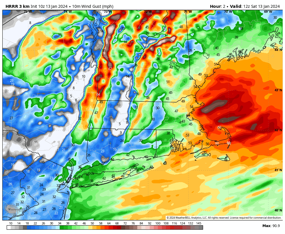
The good news is that the storm system is moving quite quickly and is what we call progressive. It will continue to move northeast, and the rain will shut down late this morning. There may even be some clearing this afternoon. Winds will continue to be gusty but not as strong as the last storm, and therefore, power outages are likely to not be as extensive.
The loop below shows the strongest winds exiting the region between about 10 a.m. and 11 a.m. moving into northern New England and then heading out to eastern Canada. Conditions will remain breezy the rest of the day and also on Sunday.
Along the South Coast, the peak surge is occurring as I write this, but for eastern Massachusetts, the surge will come later, between about 10 a.m. and 1 p.m. this afternoon. That surge will move up the coastline, and that is where those record-high water levels are likely.
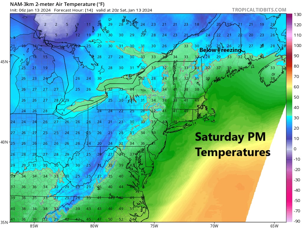
Temperatures will be very mild, reaching into the ‘50s to near 60 today, perhaps closing in on a record but likely remaining just shy.
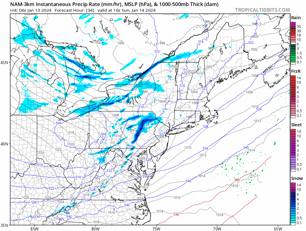
Sunday will see a mix of clouds and sunshine and another little weather system. This one will bring some rain or snow showers in the afternoon before clearing takes place. Temperatures will be notably colder, in the ‘30s and feeling in the ‘20s with the wind.
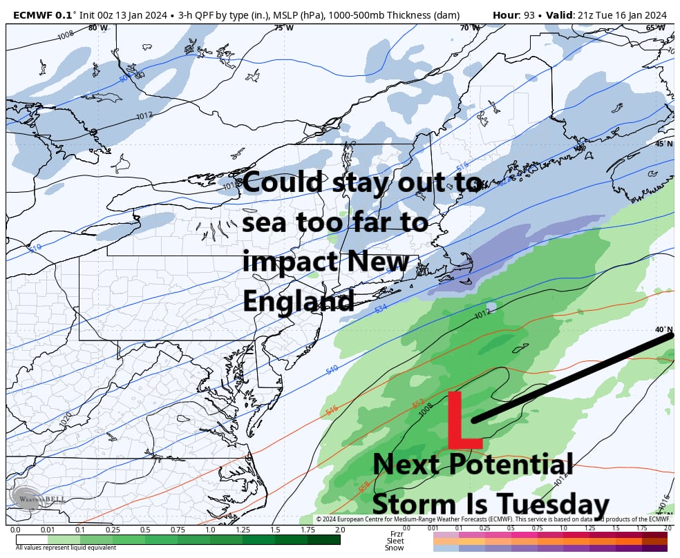
For the Martin Luther King holiday, temperatures are near 30 with sunshine. We will then have to wait on whether a storm system brings snow or stays out to sea on Tuesday.