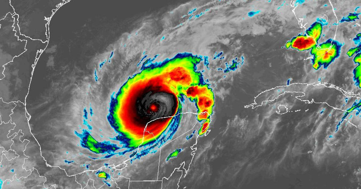
Hurricane Milton has “explosively intensified” in the southern Gulf of Mexico as it continues on its path towards Florida. Milton underwent rapid intensification, from a tropical storm on Sunday morning into a strong Category 5 hurricane in just 24 hours.
Within each public advisory that the National Hurricane Center releases, adjustments to the track of this storm system are also adjusted. The forecast track with Milton has its sights set on the western coast of Florida, but the position of the center of the storm, or the “eye,” can determine how catastrophic the impacts are on the Tampa Bay area.

NOAA/National Hurricane Center
As Milton intensified into a major hurricane with wind speeds upwards of 180 mph, the strength of the system increased the severity of the storm surge forecast to all coastal areas, including the Gulf Coast of Florida. The eastern side of the eye is considered the “dirty side” of the storm, which is where the winds tend to be the strongest. As the forecast track shifts northward, the dirty side then falls over Tampa Bay. This, in turn, creates a more severe hazard of storm surge in that confined area.
In addition, the waters on the Gulf side of Florida are much more shallow than on the Atlantic side, which can make storm surge even more impactful to communities along the Gulf.
The National Hurricane Center has increased the peak storm surge forecast from 8-12 feet to 10-15 feet of inundation for the area from Anclote River to Tampa Bay. This increased severity is directly in response to the strength of the storm as its maximum sustained wind speed increased.

NOAA/National Hurricane Center
“The deepest water will occur along the immediate coast near and to the south of the landfall location, where the surge will be accompanied by large and dangerous waves,” the NHC said in a Monday afternoon advisory. “Surge-related flooding depends on the relative timing of the surge and the tidal cycle, and can vary greatly over short distances.”
In another advisory Monday evening, NHC stated, “While fluctuations in intensity are expected, Milton is forecast to remain an extremely dangerous hurricane through landfall in Florida.”
All coastal residents and visitors are being urged to heed local officials’ evacuation orders that are in place.