Hurricane Milton rapidly strengthened to a major Category 3 hurricane Monday in the Gulf of Mexico and casting an ominous shadow toward Florida, where state emergency management officials said they were preparing for the largest hurricane evacuation since 2017.
With the track of Milton aimed right at Florida’s Gulf coast — currently somewhere between Tampa and Naples as of Monday — forecasters warned of potentially life-threatening storm surge, destructive winds and widespread torrential rain.
If peak surge occurs at high tide, experts are estimating 8 to 12 feet of surge near Tampa and around the the Anclote River to Englewood.
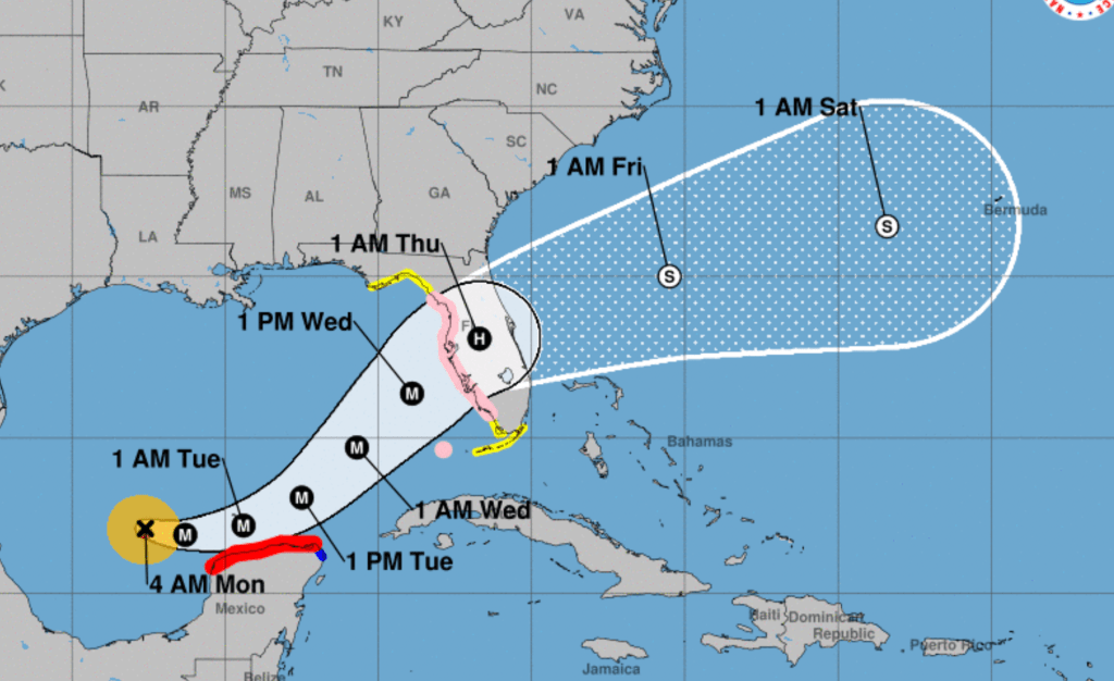
Milton is expected to be a Category 4 hurricane ahead of landfall, according to the National Hurricane Center, though forecasters said it’s still too soon to be certain about the exact track and magnitude. The storm could reach Category 4 or even 5 in the middle of the Gulf of Mexico, but some weakening is possible before landfall, hurricane center forecasters said.
“Do not try to game the forecast,” Gov. Ron DeSantis urged residents at a hurricane briefing Sunday night. “Be cautious how you’re looking at this data and make inferences you are going to be in the clear.”
DeSantis expanded a state of emergency he declared on Saturday to cover 51 counties, including Broward, Palm Beach and Miami-Dade counties. Only counties in the western Panhandle were excluded from the emergency declaration.
Milton could make landfall late Wednesday or early Thursday but its effects are likely to begin much earlier as Milton’s wind field expands over the Gulf of Mexico’s warm and deep waters.
Milton’s forecast cone “covers almost the entire west coast of Florida,” DeSantis said Sunday. “(It’s) not any type of storm that has been dealt with, certainly in recent years … This is an unusual track in terms of it coming in from the Pacific Ocean, hopping across Mexico, forming and then coming horizontally into the west coast of Florida.”
‘Of course we’re worried’: South Floridians prepare to hunker down ahead of Hurricane Milton
DeSantis said Sunday that while it remains to be seen just where Milton will strike, it’s clear that Florida is going to be hit hard — “I don’t think there’s any scenario where we don’t have major impacts at this point.”
The state’s Director of Emergency Management, Kevin Guthrie, said the state is preparing for the largest hurricane evacuation since 2017, when Hurricane Irma cut through the entire length of the Florida peninsula from the Keys to Georgia.
At the Sunday evening news conference, emergency management officials urged residents to use the website fl511.com for emergency evacuation information.
The state has prepared emergency fuel sources and electric vehicle charging stations along evacuation routes, and “identified every possible location that can possibly house someone along those routes,” Guthrie said. People who live in homes built after Florida strengthened its codes in 2004, who don’t depend on constant electricity and who aren’t in evacuation zones, should probably avoid the roads, he said.
The forecast track for Milton is particularly concerning for the Tampa Bay area.
DeSantis said Sunday that Milton is expected to make landfall in Pinellas County. Still, “models can shift,” he warned. “Don’t get wedded to where the landfall is being predicted right now. The cone, at this point, effectively, can bring it almost anywhere on the western Florida peninsula.”
DeSantis stated that crews readying to mobilize for power restoration, and that Milton may cause outages greater than those brought by Hurricane Helene.
There is a “massive amount of resources being marshalled,” he added.
The Federal Emergency Management Agency, meanwhile, coordinated with the governor and briefed President Joe Biden Sunday on how it has staged lifesaving resources.
“If the center of Milton tracks just to the north of Tampa Bay, the scope of potential storm surge is impossible to imagine,” Fox Weather hurricane specialist Brian Norcross wrote on his blog, Hurricane Intel. “Think of of Helene’s surge and add another few feet.”
Milton is expected to bring rain totals of 5 to 8 inches, with localized areas seeing potentially up to 12 inches, across portions of the Florida peninsula and the Keys through Wednesday night. That will come on top of moisture ahead of the hurricane that is already saturating the state.
A flood watch is in effect for all of South Florida lasting into Thursday morning.
Since many of the counties under the Milton state of emergency are still recovering from Hurricane Helene, DeSantis asked the Florida Division of Emergency Management and the Florida Department of Transportation to coordinate all available resources and personnel to supplement local communities as they expedite debris removal.
As many as 4,000 National Guard troops are helping state crews to remove the tons of debris left behind by Helene, DeSantis said, and he directed that Florida crews dispatched to North Carolina in Helene’s aftermath return to the state to prepare for Milton.
As of 7 a.m. Monday, Milton was located about 750 miles west-southwest of Tampa, moving east-southeast at 8 mph with maximum sustained winds of 120 mph.
Hurricane-force winds extend outward up to 25 miles from the center, and tropical-storm-force winds extend outward up to 80 miles from the center.
With Milton achieving hurricane status, this is the first time the Atlantic has had three simultaneous hurricanes after September, said Colorado State University hurricane scientist Phil Klotzbach. There have been four simultaneous hurricanes in August and September.
The projected impact of Milton to the South Florida region is still being assessed, but is generally expected to be late Tuesday into Thursday.
Other tropical systems

Far in the Atlantic, there’s Hurricane Leslie and a weakening Hurricane Kirk. Neither is a threat to land.
Leslie, located 1,065 miles west of Africa’s southernmost Cabo Verde Islands, had a maximum sustained wind speed of 90 mph and was moving northwest at 13 mph as of 5 a.m. Monday. In the five-day track, forecasters are projecting the storm to turn to the northwest, away from the Caribbean, and increase in forward speed. Leslie may begin weakening sometime in the next day or so.
Swells and rip currents generated by Kirk were continuing to affect the U.S. East Coast and parts of the Caribbean and Atlantic on Monday.
In addition, the National Hurricane Center is watching a tropical wave that is expected to move off the west coast of Africa in a few days, although the chance of development is low, with a 30% chance through the next seven days.
The next named storm will be Nadine.
Staff writer Lisa J. Huriash contributed to this report, which was supplemented by information from the Associated Press.
Forecasts for Hurricane Helene’s path were uncannily accurate. Here’s why.