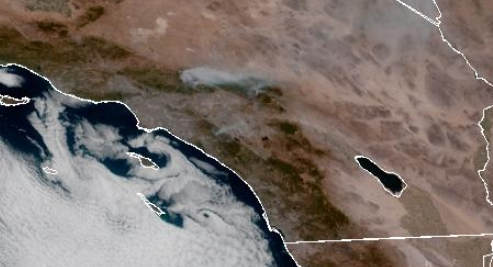
Satellite images from the National Oceanic and Atmospheric Administration are offering a unique view of three wildfires raging in Southern California this week.
NOAA’s GOES-West satellite is capturing images of the western United States every five minutes. The pictures are then compiled into a timelapse loop and made available online.
The animation shows the sun rising over the region Wednesday morning and giant plumes of brown smoke billowing from the Bridge Fire in the San Gabriel Mountains of Los Angeles and San Bernardino counties, the Line Fire in the San Bernardino Mountains, and, further south, the Airport Fire in Orange and Riverside counties.
Tens of thousands of homes and buildings are threatened as the wildfires, fueled by a recent triple-digit heat wave, continue to spread. Evacuation orders have been expanded to include areas such as the popular ski town of Big Bear and the entire community of Wrightwood.
The Airport Fire has left behind scorched cars, rubble and ash in Orange County.
The White House said President Joe Biden is closely monitoring the situation and urged residents to follow state and local evacuation orders.
Although California is just entering the height of wildfire season, the state has already seen nearly three times more land burn than in all of 2023.