In a hurry? Here’s the tropics situation in less than a minute.
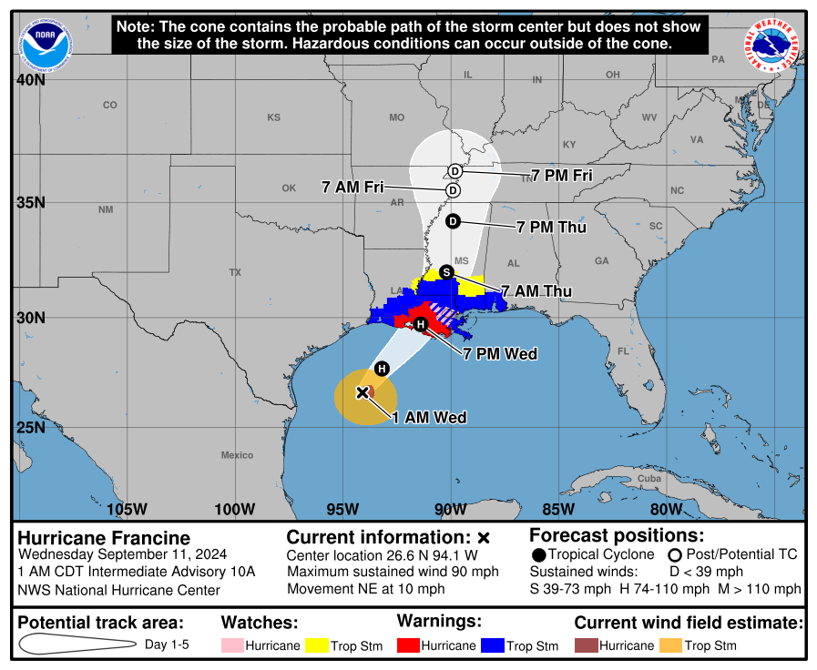
Francine continued to strengthen overnight, after becoming a hurricane around 8 p.m. Tuesday night, according to the latest advisory from the the National Hurricane Center.
The storm now has winds of 90 mph, making it a strong Category 1 storm.
Life-threatening storm surge and hurricane-force winds are expected to begin in Louisiana later today.
➤Spaghetti models for Francine
➤ Weather alerts via text: Sign up to get updates about current storms and weather events by location
“Significant strengthening seems likely through Wednesday morning while the system remains over very warm waters and in low wind shear conditions,” the Hurricane Center said. Francine is expected to be near Category 2 strength later this morning.
There are no tropical storm or hurricane watches or warnings issued for Florida, although several areas along the Panhandle are under flood watches.
While landfall is expected in Louisiana, the western Panhandle of Florida could face several threats, including:
Escambia County Public Schools announced Tuesday it has canceled all practices, games and extracurricular activities for Wednesday afternoon and evening.
Florida Panhandle impacts: Will Tropical Storm Francine impact the Florida Panhandle? Here’s what to know
Where is Hurricane Francine? What you need to know

-
Location: 195 miles east-northeast of the mouth of the Rio Grande; 275 miles southwest of Morgan City, Louisiana
-
Maximum sustained winds: 90 mph
-
Movement: northeast at 10 mph
-
Pressure: 977 mb
Interactive map: Excessive rainfall forecast
Spaghetti models: Latest models on where Hurricane Francine could make landfall
Special note about spaghetti models: Spaghetti model illustrations include an array of forecast tools and models, and not all are created equal. The Hurricane Center uses only the top four or five highest performing models to help make its forecasts.
Watches, warnings issued across Florida, US
Hurricane warning:
Storm surge warning:
Storm surge watch:
Hurricane watch:
Tropical storm warning:
-
Louisiana coast east of Sabine Pass to Vermilion/Cameron Line
-
East of Grand Isle Louisiana to the Alabama/Florida border
-
Lake Maurepas and Lake Pontchartrain, including metropolitan New Orleans
How strong is Hurricane Francine and where is it going?
At 1 a.m. CDT, the center of Hurricane Francine was located near latitude 26.6 North, longitude 94.1 West. Francine is moving toward the northeast near 10 mph.
A faster northeastward motion is expected today, and Francine is anticipated to make landfall in Louisiana within the warning area this afternoon or evening.
After landfall, the center is expected to move northward into Mississippi tonight and Thursday.
Data from the Air Force Hurricane Hunters indicate that maximum sustained winds have increased to near 90 mph, with higher gusts.
Some additional strengthening is expected this morning.
Francine is expected to weaken quickly after it moves inland.
Hurricane-force winds extend outward up to 35 miles from the center, and tropical-storm-force winds extend outward up to 115 miles.
The minimum central pressure based on data from the Air Force Hurricane Hunters is 977 mb.
Key messages from the National Hurricane Center: What you need to know about Hurricane Francine
-
There is a danger of life-threatening storm surge on Wednesday for the Louisiana and Mississippi coastlines, where a storm surge warning is in effect. Residents in the warning area should follow advice, including evacuation orders, given by local officials.
-
Damaging and life-threatening hurricane-force winds are expected in portions of southern Louisiana on Wednesday, where a hurricane warning is in effect. Preparations to protect life and property should be complete, since tropical storm conditions are expected to begin within this area early Wednesday.
-
Francine is expected to bring heavy rainfall and the risk of considerable flash and urban flooding across eastern Louisiana, Mississippi, far southern Alabama and the western Florida Panhandle through Thursday. Flash and urban flooding is probable across the Lower Tennessee Valley and Lower Mississippi Valley Wednesday night into Friday morning.
Current forecast: How strong could Hurricane Francine get?
What impact could Hurricane Francine have and what areas could be affected?
-
WIND: Hurricane conditions are expected within the hurricane warning area this afternoon, with tropical storm conditions arriving in the warning area this morning. Hurricane conditions are possible in the hurricane watch area this afternoon and tonight. Tropical storm conditions are expected in the warning area along the coasts of Louisiana, Mississippi, and Alabama today and tonight.
-
RAINFALL: Francine is expected to bring storm total rainfall of 4 to 8 inches, with local amounts to 12 inches across eastern Louisiana, Mississippi, far southern Alabama and the western Florida Panhandle through Friday morning. This rainfall could lead to considerable flash and urban flooding.
-
STORM SURGE: The combination of a dangerous storm surge and the tide will cause normally dry areas near the coast to be flooded by rising waters moving inland from the shoreline.
-
The deepest water will occur along the immediate coast near and to the east of the landfall location, where the surge will be accompanied by large and dangerous waves. Surge-related flooding depends on the relative timing of the surge and the tidal cycle, and can vary greatly over short distances. Storm surge is not expected to pose a threat to the risk reduction system levees. However, there may be some overtopping of local levees.
-
The water could reach the following heights above ground somewhere in the indicated areas if the peak surge occurs at the time of high tide:
-
Vermilion/Cameron Line, LA to Port Fourchon, LA…5-10 feet
-
Vermilion Bay…5-10 feet
-
Port Fourchon, LA to Mouth of the Mississippi River, LA…4-7 feet
-
Cameron, LA to Vermilion/Cameron Line, LA…3-5 feet
-
Pointe a la Hache, LA to MS/AL Border…3-5 feet
-
Lake Pontchartrain and Lake Maurepas…3-5 feet
-
-
TORNADOES: A few tornadoes are possible today into tonight across parts of southeast Louisiana, southern Mississippi, southern Alabama, and the Florida Panhandle.
-
SURF: Swells generated by Francine are affecting much of the northern and northwestern Gulf Coast, likely causing life-threatening surf and rip current conditions.
Atlantic tropics storm tracker
See new ‘cone of concern’ used with Hurricane Francine
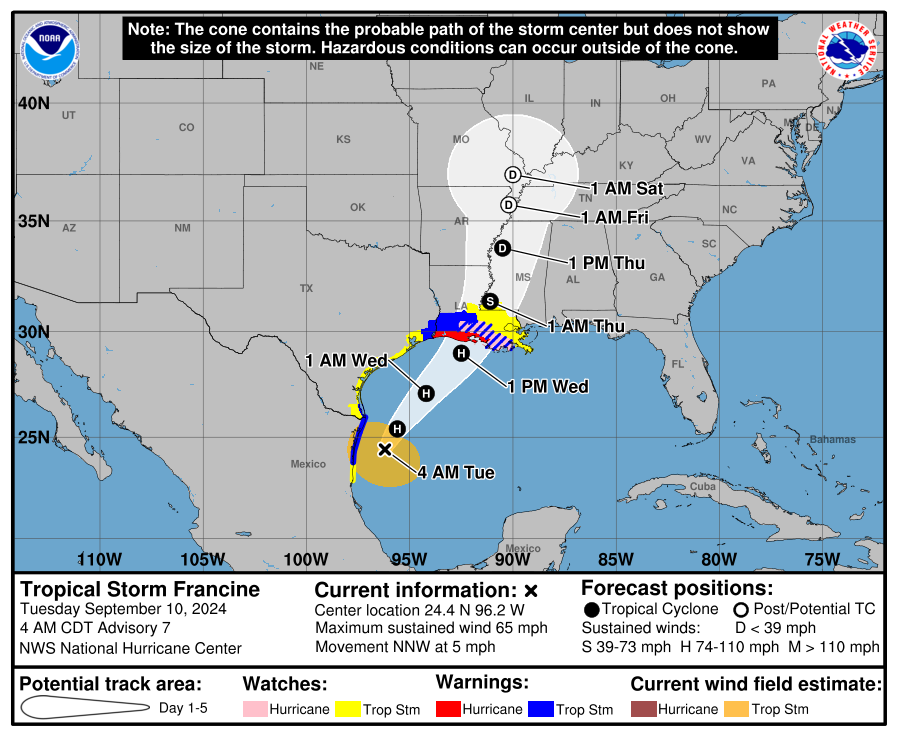
The National Hurricane Center first launched its new “cone of concern” for Hurricane Ernesto on Aug. 14 and is using it now with Hurricane Francine.
Ernesto stayed well away from Florida and the U.S., so residents didn’t see many differences between the original and new cone.
As Francine approaches the northern Gulf Coast, that’s not the case with the new cone posted by the National Hurricane Center on its website.
One of the biggest differences between the two cones is that the new cone shows wind warnings issued for interior counties, not just those on the coast.
Both cones will be visible on the Hurricane Center’s website. Find the new cone by going to the graphics page for the storm, then click on “New Experimental Cone,” which is highlighted in red.
Differences you’ll see:
-
Watches and warnings for inland counties, not just coastal areas.
-
White transparent shading for the entire five-day forecast, instead of white stippling (dots) for the four- and five-day forecast.
Stay informed. Get weather alerts via text
What’s next?
We will continue to update our tropical weather coverage as conditions change. Download your local site’s app to ensure you’re always connected to the news. And look for our special subscription offers here.
This article originally appeared on Treasure Coast Newspapers: Hurricane Francine update, tracker. Florida impacts