After monitoring four different disturbances for potential tropical development in the Atlantic basin, attention is now focusing on a tropical disturbance that has eyes on the southern Gulf of Mexico just as the hurricane season reaches its climatological peak on Sept. 10.
The disturbance has spent more than a week making the journey across the Atlantic as a tropical wave, clinging to a disorganized cluster of showers and thunderstorms as it struggled to find conditions conducive for development.
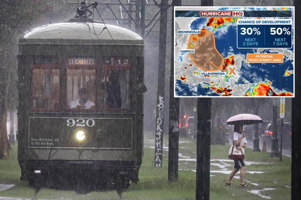
That remains the case as the disturbance currently sits near Belize and Mexico’s Yucatan Peninsula.
But forecasts have the wave moving into the Bay of Campeche on Saturday where it could interact with a frontal boundary, according to the National Hurricane Center.
“We have a tropical wave that you can see some rotation in the cloud pattern here that’s moving inland across Belize and across the Yucatan Peninsula,” National Hurricane Director Dr. Michael Brennan told FOX Weather Friday.
“And when that moves out into the southern Gulf of Mexico, well, to the south of this boundary, it looks like it might encounter some conditions that will allow it to try and go on and develop.”
The system could pick up enough strength to become a tropical depression during the early to middle part of next week as it slides into the southwestern Gulf of Mexico, the NHC said.
The agency has now given the disturbance a medium chance of development over the next week — the highest rating its had in several days.
“We’re giving out a 40% chance of development over the next week, so we could see a tropical depression form down here, early to middle portions of next week. And then that could eventually become a threat to, say, somewhere along the western Gulf Coast,” Brennan said.
“Pretty early to tell. But again, just a reminder, even though we’ve had a pretty long break here in the Atlantic, we’ve still been watching lots of systems. They just haven’t had a really good chance of development. But this is sort of our best candidate at the moment.”

NHC Head: Don’t let your guard down
Brennan warns that despite what has become a historically quiet period in the tropics over the past month, don’t give up on the hurricane season yet.
“The main message to people is at this point, don’t pay any attention to the seasonal forecast. We still got about 60% of the activity in a typical hurricane season to come, even after we get to early September,” he said.
“And the important thing for people in the United States is that the threat, as we get later in the season, shifts back over closer to us, where we’re going to have the potential for system to develop in the Caribbean and the Gulf off the East coast, that can become the sort of short-fuse hurricane events that we’re always so worried about.”