It looks increasingly likely that a tropical cyclone may be brewing in the Atlantic, as forecasts show a disturbance heading toward the Caribbean.
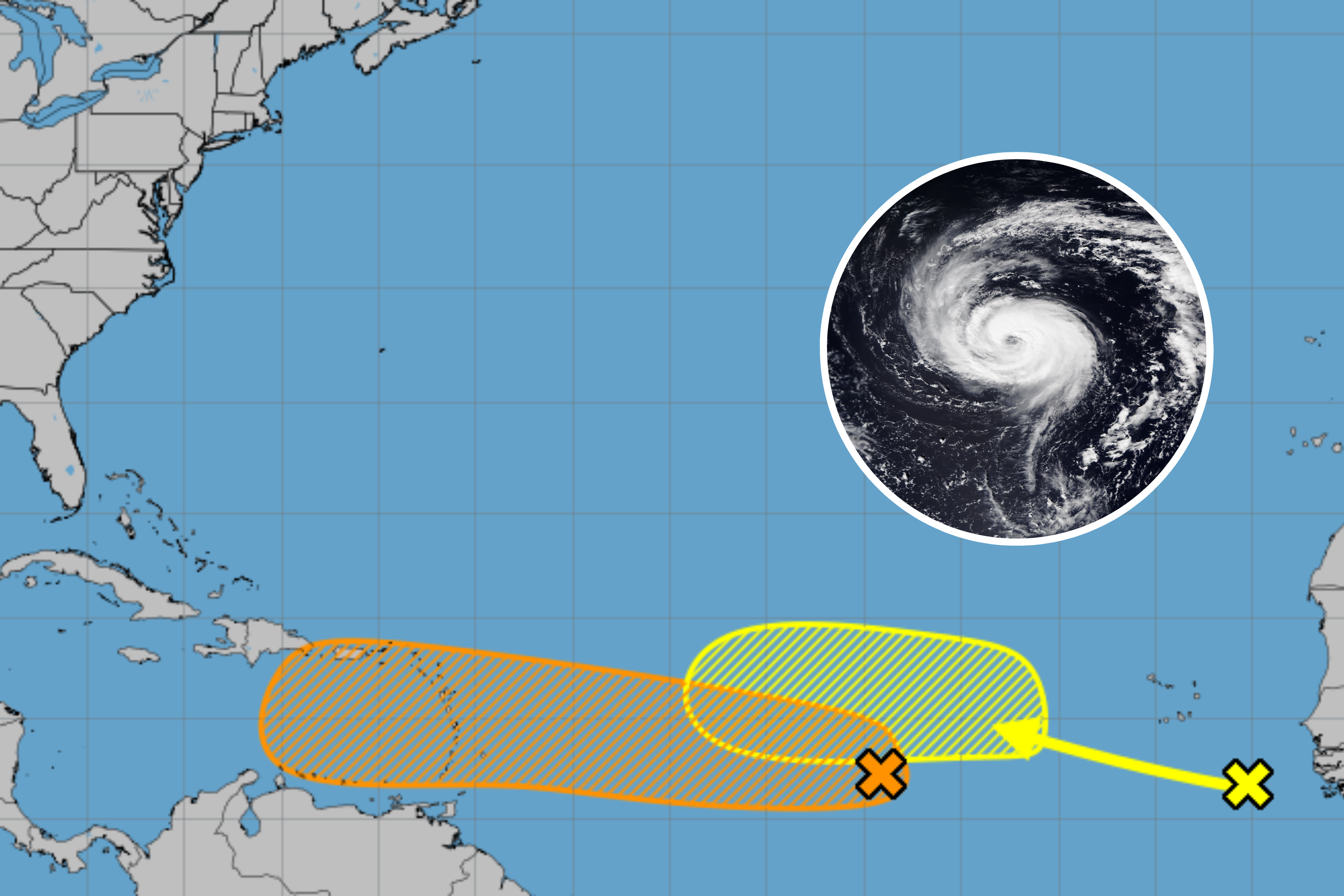
The system building over the central Tropical Atlantic now has a 50 percent chance of becoming a cyclone in the next seven days, according to the National Hurricane Center (NHC).
If it forms, the system is predicted to head westward over the ocean, possibly making landfall in the Caribbean islands in the middle part of next week.
National Hurricane Center NHC / NOAA
“A tropical wave over the central Tropical Atlantic continues to produce disorganized showers and thunderstorms that are a little more concentrated near its axis,” the NHC said in a Tropical Weather Outlook on Friday.
“Environmental conditions appear conducive for gradual development of this system, and a tropical depression could form by early next week while it moves westward at 10 to 15 mph, approaching the Lesser Antilles.”
While the likelihood of a cyclone developing in the next 48 hours remains low—the NHC says the chance is just 10 percent—the odds of it reaching cyclone strength in the midterm are increasing.
Earlier in the week, forecasters predicted the likelihood of a cyclone developing over a seven-day period as just 20 percent.
A tropical cyclone begins as a tropical depression, characterized by clusters of thunderstorms around a low-pressure center but without the organized structure seen in stronger systems.
When wind speeds surpass 39 mph, it is classified as a tropical storm. If the winds reach 74 mph, the system is then categorized as a hurricane or a typhoon in the Northwest Pacific.
As if one cyclone wasn’t enough, a second system may also be developing in tow. The NHC said another tropical wave just west of the coast of Africa has a 20 percent chance of reaching cyclone status in the next week.
8pm EDT Aug 29th — NHC is now monitoring two tropical waves, one in the central Tropical Atlantic that has a medium chance (50%🟠) & one off the coast of Africa that has a low chance (20%🟡) of TC development over the next 7 days.
Latest Outlook: https://t.co/DboWSR4Ct1 pic.twitter.com/PDkxSyeAD2
— National Hurricane Center (@NHC_Atlantic) August 30, 2024
Over the next 48 hours, however, the disturbance in the Eastern Tropical Atlantic has a zero percent chance of becoming a cyclone, the NHC added.
“Another tropical wave just west of the coast of Africa is currently associated with an area of disorganized showers and thunderstorms. Some slow development of this system is possible through the middle portion of next week as it moves slowly to the west-northwest or northwest over the Eastern Tropical Atlantic,” the NHC said in the Tropical Weather Outlook.
In the tropics, a broad zone of low pressure extends on both sides of the equator, with northeast winds on the north side and southeast winds on the south side. Within this low-pressure zone, warm tropical oceans heat the air, causing it to rise and form thundery showers.
These showers typically dissipate, but occasionally they cluster into large groups, creating a flow of warm, moist air that leads to the development of a low-pressure center at the surface.
For these cloud clusters to evolve into a tropical cyclone, several conditions must align: warm, moist air from tropical oceans with sea surface temperatures of at least 27 degrees Celsius; converging surface winds that cause air to rise and form storm clouds; low wind shear, allowing storm clouds to rise vertically; and sufficient distance from the equator to provide the necessary spin or twist.
Do you have a tip on a science story that Newsweek should be covering? Do you have a question about cyclones? Let us know via science@newsweek.com.