Widespread highs into the upper 90s and triple-digits are forecast to span from the Southwest to the central Gulf Coast
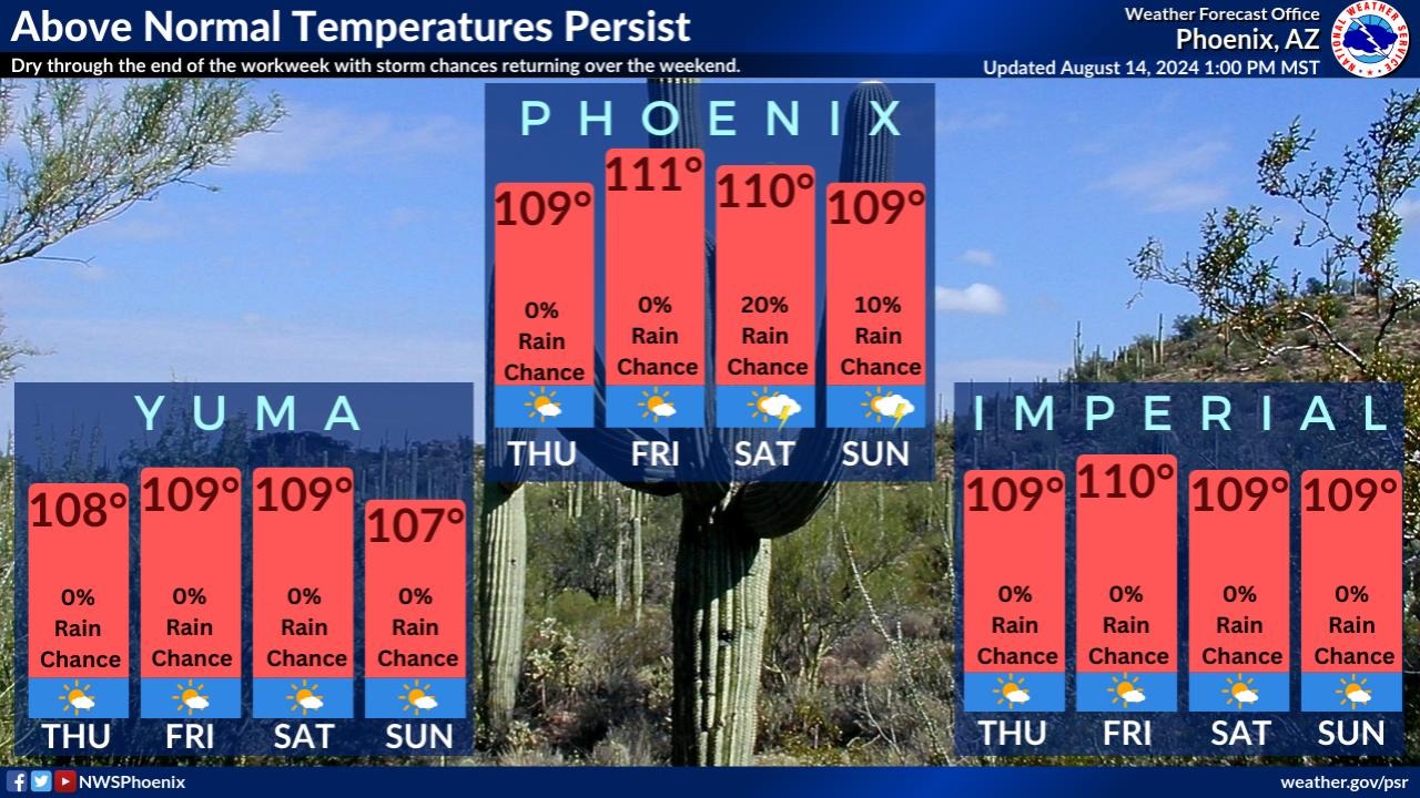
From the National Weather Service:
Heat will remain the major weather story throughout much of the south-central U.S. through the end of this week and likely beyond.
Elevated humidity levels will soar heat indices up to around 110 degrees in the southern Plains, lower Mississippi Valley, and central Gulf Coast. Low temperatures are anticipated to only drop into the upper 70s and 80s for many locations, which could break several daily records. This level of heat can affect anyone without effective cooling and/or adequate hydration.
Temperatures in New Orleans:

NWS HeatRisk: Identifying Potential Heat Risks in the Seven Day Forecast
The NWS HeatRisk is an experimental color-numeric-based index that provides a forecast risk of heat-related impacts to occur over a 24-hour period.
Aug. 15-20, 2024 HeatRisk map


HeatRisk takes into consideration:
- How unusual the heat is for the time of the year
- The duration of the heat including both daytime and nighttime temperatures
- If those temperatures pose an elevated risk of heat-related impacts based on data from the CDC
Understanding the Heat Index Temperatures

Aug. 20-24, 2024:
