The National Weather Service confirmed at least 11 tornadoes struck Northern Illinois and Northwest Indiana Monday evening during a severe weather outbreak that downed and uprooted trees, tore apart roofs and left hundreds of thousands without power.
The findings come as the NWS worked Tuesday to begin analyzing 29 different paths of potential damage, from the suburbs, to the city, to Northwest Indiana. In a message posted Tuesday night to on X, the platform formerly known as Twitter, the NWS said the numbers are preliminary, and stand to go up.
“We still has well over a dozen locations that we need to survey and analyze.”
As of 9:30 p.m. Tuesday, here are the confirmed tornadoes and locations that struck the region Monday:
- Yorkville to Naperville EF-1; est. peak winds 100 mph
- Chicago – Near West Side towards Loop; EF-1; est. peak winds 95 mph
- Channahon to Frankfurt EF-1; est. peak winds 105 mph. NWS says tornado track likely extended further west, and rating may need to be upgraded
- Crest Hill to Lockport EF-0; est. peak winds 75 mph. NWS says tornado track likely extended further west
- Byron EF-0; est. peak winds 80 mph
- Davis Junction EF-0; est. peak winds 80 mph
- Cedar Lake to Crown Point Indiana EF-1; est. peak winds 90 mph
- Chicago Lawn to West Englewood EF-1; est. peak winds 90 mph
- Justice EF-1; est. peak winds 90 mph
- Sugar Grove to North Aurora EF-0; est. peak winds 90 mph
- Southern Winnebago County EF-0 (exact track still TBD)
According to the NWS, Monday’s confirmed tornadoes make up a total of 17 tornadoes in the region since Sunday.
Maps showed the Chicago area riddled with potential paths of damage.
The storms barreled through the area from west to east Monday, prompting tornado watches and warnings in every Chicago-area county.
The National Weather Service called the line a series of “destructive thunderstorms” while the NBC 5 Storm Team called it an “incredibly active night.”
“It’s been years and years since we’ve seen something like this,” NBC 5 Storm Team Meteorologist Kevin Jeanes said.
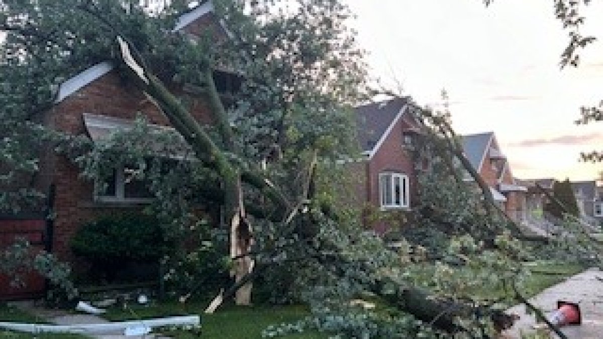
The series of “destructive” storms left behind a trail of damage, with photos and videos showing massive trees uprooted from sidewalks, blocking streets and crushing cars.
MORE: Illinois dam fails after heavy rains and tornadoes sweep across state; hundreds told to evacuate
In Cedar Lake Indiana, where the NWS confirmed a tornado had struck, one woman was killed when a tree fell on a home.
As of 5:30 a.m. Wednesday, according to ComEd’s outage map, more than 75,000 people remained without power. That number was down from more than 400,000 at the height of the storm. According to officials, power is expected to be restored to customers by 6 p.m. Friday.
In Northwest Indiana, utility company NIPSCO reported 40,900 people without power Wednesday morning.
“We continue to expect this to be a multi-day outage for some customers, and we recommend customers make the plans necessary to keep themselves and their families safe during an extended outage,” a message posted to their site said. “We will provide updated information on restoration times as the storm response progresses.”