After being stifled by heat and humidity the last several days and battered by strong storms each of the last two nights, Chicagoland will gladly welcome some quiet weather.
And that’s exactly what we’ll be getting for the next several days.
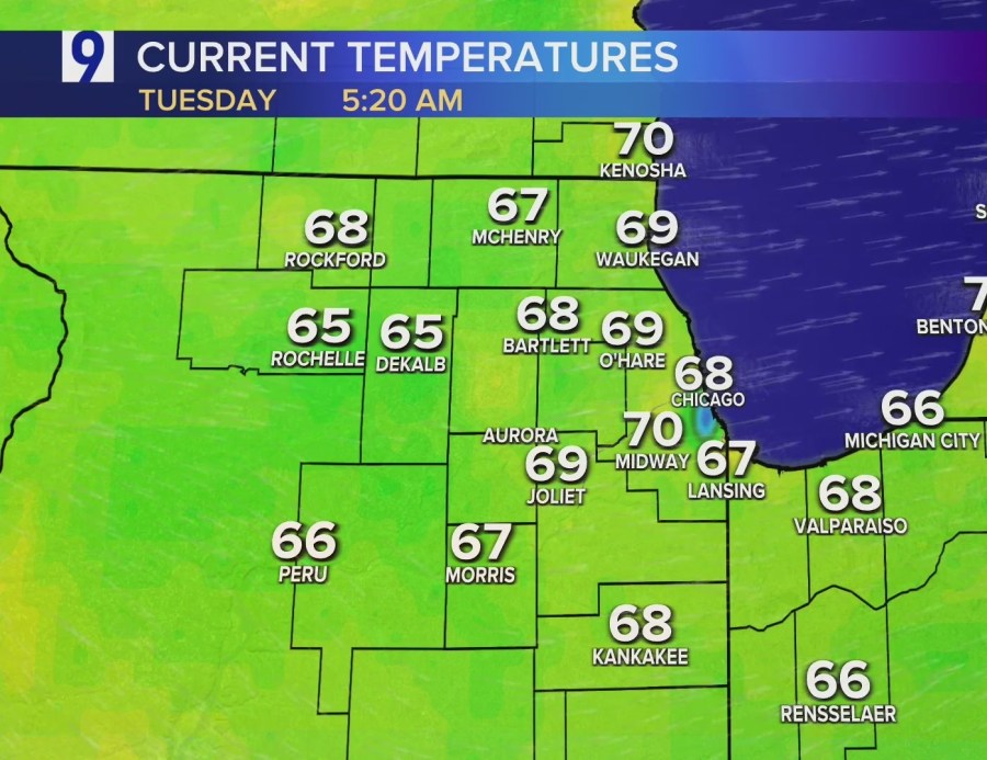
The humidity will still be high on Tuesday, with dew points again getting into the 70s and high temps in the mid-80s, even the upper 80s in some areas. Early-morning temps were already in the upper 60s to lower 70s, with dew points in the mid- to upper 60s.

However, other than a slight chance for a pop-up shower or two later, Tuesday will remain dry, with cloud cover decreasing during the afternoon.
Then, by the time Chicagoland wakes up Wednesday morning, the humidity will be significantly down and more comfortable air will be settled over the area. That will kick off a stretch of cooler, drier weather, with plenty of sunshine.

Forecast
TODAY: Decreasing clouds, 20% shower/storm chance, still humid, winds W at 5-10 mph. High: 85.
TONIGHT: Partly cloudy, winds N at 0-5 mph. Low: 67.
TOMORROW: Mostly sunny, winds NNW at 5-10 mph, gusts to 15. High: 80/77.