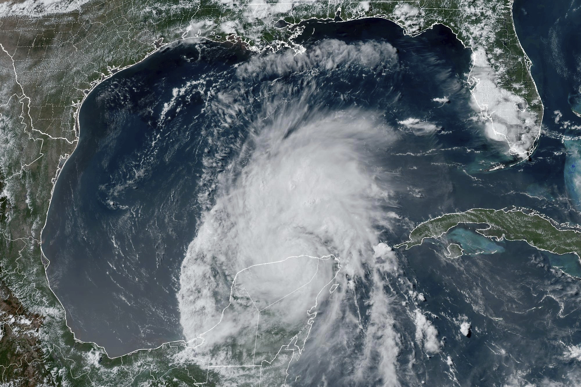
Tropical Storm Beryl is forecast to gain strength ahead of making landfall on Texas’ Gulf Coast Monday, with the National Hurricane Center (NHC) warning of “life-threatening storm surge” that could bring water up to 6 feet above ground level.
Beryl, which has fluctuated between different categories on the hurricane scale due to rapid intensification, is now categorized as a tropical storm and has near 60 mile per hour maximum sustained winds and even higher gusts.
Earlier, Beryl attained Category 5 status with winds reaching 165 mph, making it the earliest Category 5 storm in the Atlantic. It previously passed through the Caribbean islands, causing at least 11 deaths, according to the Associated Press.
As of Saturday afternoon, the NHC placed the storm about 385 miles southeast of Corpus Christi, Texas, moving at 13 mph. It’s expected to make landfall in southern Texas early Monday morning and the NHC predicts “significant strengthening” before landfall.
(NOAA via AP
The NHC warned Texans of “life-threatening storm surge along portions of the lower and middle Texas coast late Sunday into Monday.”
In a post on X, formerly Twitter, on Saturday afternoon NHC Director Michael Brennan emphasized the highest concern is for residents living between San Luis Pass and Baffin Bay, which includes Matagorda, Corpus Christi, and Galveston. The regions under storm surge watch extend from the mouth of the Rio Grande to High Island, Texas.
The NHC’s latest update at 5 p.m. ET warns that Matagorda Bay and from Mesquite Bay to Sargent, Texas, could experience water levels reaching 4 to 6 feet above ground level. Corpus Christi Bay, meanwhile, is expected to see water rise 3 to 5 feet above ground level. A hurricane warning is in effect for the Texas coast from Baffin Bay to Sargent.
The NHC also warned of considerate flash flooding as heavy rainfall between “5 to 10 inches with localized amounts of 15 inches is expected across portions of the Texas Gulf Coast and eastern Texas beginning late Sunday through midweek.”
Lieutenant Governor Dan Patrick said that the state is preparing for the “worst-case scenario.” He is serving as the acting governor while Governor Greg Abbott is on a business trip to Asia and will remain in this position until July 12. He issued a preemptive disaster declaration for 121 Texan counties, according to the AP.
Newsweek left a voice message for Patrick’s office on Saturday for comment.
Texas officials have suggested that residents take steps now to prepare for Beryl’s impending landfall, such as fueling their cars.
Uncommon Knowledge
Newsweek is committed to challenging conventional wisdom and finding connections in the search for common ground.
Newsweek is committed to challenging conventional wisdom and finding connections in the search for common ground.