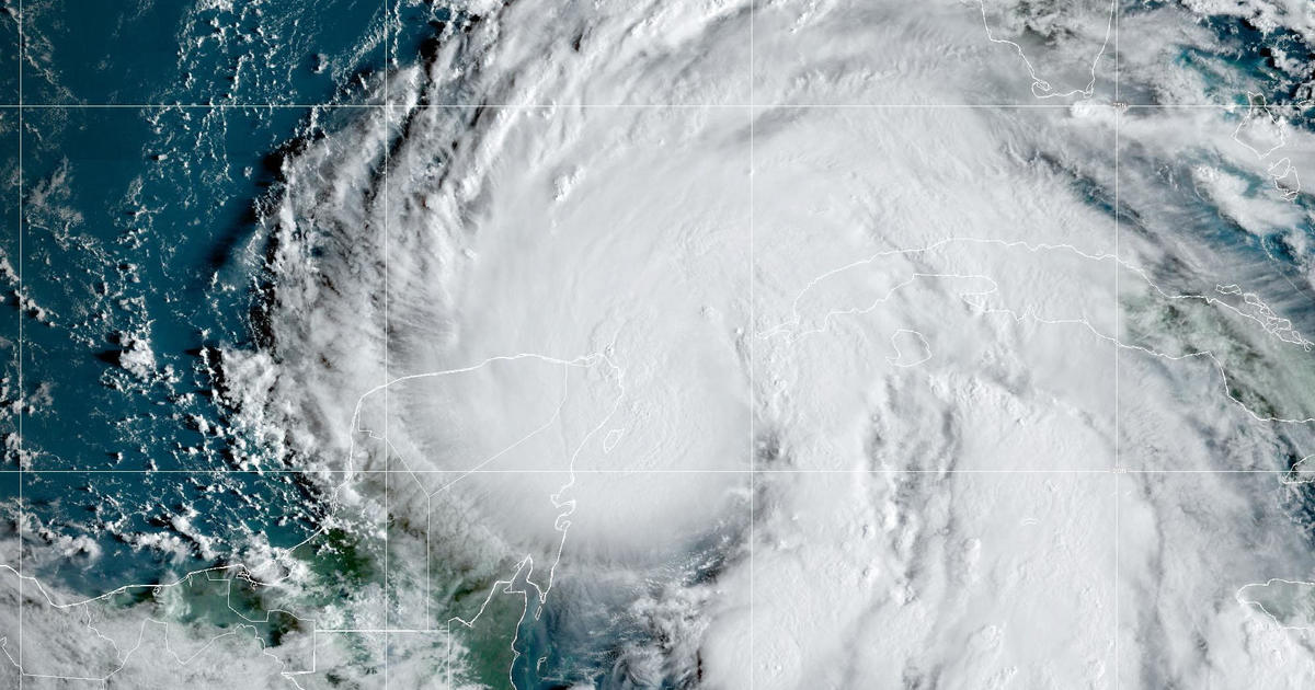
Helene strengthened into a hurricane Wednesday as it was leaving the Caribbean Sea on a path for Florida’s Gulf Coast. The hurricane was expected to become more powerful as it moves through the warm waters of the Gulf of Mexico.
The storm had maximum sustained winds of 80 mph Wednesday morning, making it a Category 1 storm, according to the National Hurricane Center in Miami. The hurricane center uses five categories for hurricanes and considers storms that are at least a Category 3, with sustained winds over 110 mph, to be a major hurricane.
“We think that significant strengthening is going to occur here over the eastern Gulf of Mexico, potentially taking this to a Category 3 or major hurricane,” Jamie Rhome, a deputy director at the hurricane center, told CBS News on Wednesday.
The storm was expected to bring “life-threatening storm surge, damaging winds and flooding rains to a large portion of Florida and the southeastern United States,” the hurricane center said.
In Florida’s Big Bend area, from Carrabelle to Chassahowitzka, forecasters expected the water to reach 10-15 feet above ground if the storm surge’s peak occurred at the same time as high tide. Other areas could see anywhere from 3-10 feet of water, according to the hurricane center.
“The water impacts are probably going to be the most impactful part of the storm, the most deadly part of the storm,” Rhome said.

NOAA/NESDIS/STAR GOES-East
Watches and warnings were issued throughout Florida ahead of the storm. President Biden and Gov. Ron DeSantis declared emergencies for the state earlier in the week, and evacuation orders were issued in several counties. At the University of Tampa, officials were trying to evacuate all residential students by Wednesday afternoon.
Helene is expected to make landfall on Thursday, and it won’t just affect Florida, Rhome said.
“I’m really concerned that southern Georgia is going to have a big impact well beyond where the center makes landfall,” Rhome told CBS News.
Record-warm water in the Gulf would act like jet fuel in intensifying the storm. Brian McNoldy, senior research associate at the University of Miami Rosenstiel School of Marine, Atmospheric, and Earth Science, recently noted that ocean heat content in the Gulf of Mexico is the highest on record. Warm water is a necessary ingredient to strengthen tropical systems.
Sea surface temperatures in the path of Helene are as warm as 89 degrees Fahrenheit — 2 to 4 degrees F above normal. These record water temperatures have been made significantly more likely by human-caused climate change, according to Climate Central. The North Atlantic Ocean as a whole has seen record warm temperatures in 2024, storing 90% of the excess heat from climate change produced by greenhouse gas pollution.
Florida radar map
Ahead of Helene’s expected arrival in Florida, this radar map shows rainfall across the state.