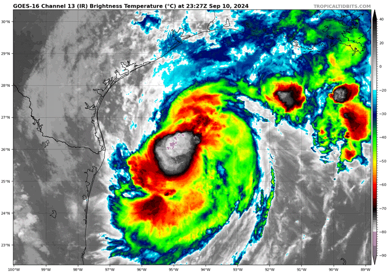
Life-threatening storm surge, heavy rainfall, and the risk of considerable flash and urban flooding across eastern Louisiana, Mississippi, far southern Alabama, and the western Florida Panhandle through Thursday.
Cat. 1 Hurricane Francine is expected to make landfall Wednesday afternoon, bringing life-threatening storm surge —up to 10 feet or potentially higher—for the Louisiana/Mississippi coastlines
New Orleans in the area of high impact with potentially hurricane-force wind gusts and 10” of rainfall.


Severe Weather threat in the central Gulf Coast
From the National Weather Service NOAA Storm Prediction Center
In addition to the threat of hurricane-force winds, considerable flooding, and dangerous storm surge in association with Tropical Cyclone Francine, a few tornadoes will also be possible across the central Gulf Coast vicinity on Wednesday into Wednesday night. The attached graphic shows where the greatest tornado threat is currently forecast.
