As Hurricane Francine approaches the northern Gulf Coast, further strengthening is expected before landfall later today or tonight.
While landfall is expected in Louisiana, impacts may be felt as far east as Florida’s Panhandle, which could see a threat for tornadoes, heavy rain, flash flooding and dangerous rip currents.
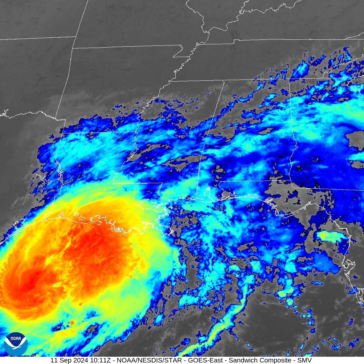
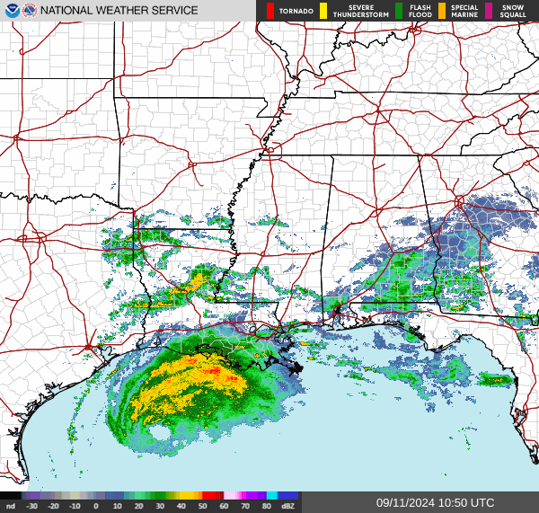
See the latest spaghetti models and watch National Weather Service radar as the hurricane approaches Louisiana.
➤Spaghetti models for Francine
➤ Weather alerts via text: Sign up to get updates about current storms and weather events by location
Where is Hurricane Francine? What you need to know
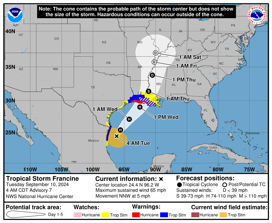
Spaghetti models: Latest models on where Hurricane Francine could make landfall
Track Hurricane Francine: Watch live radar as rain bands reach coast ahead of landfall
Watches, warnings issued across US
Excessive rainfall forecast
Power outages reported as Hurricane Francine approaches, makes landfall
Stay informed. Get weather alerts via text
Francine path tracker
What’s next?
We will continue to update our tropical weather coverage as conditions change. Download your local site’s app to ensure you’re always connected to the news. And look for our special subscription offers here.
This article originally appeared on Treasure Coast Newspapers: Hurricane Francine live radar, spaghetti models, rainfall forecast