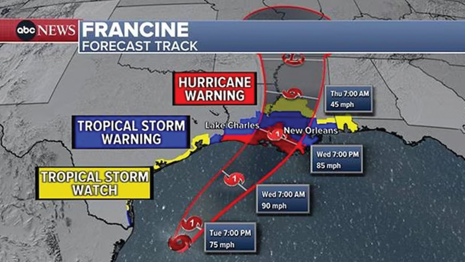
Tropical Storm Francine is now a Category 1 hurricane.
The weather pattern strengthened on Tuesday night, reaching 75 mph winds as it took aim at the Gulf Coast.
Francine is expected to make landfall Wednesday afternoon or early evening in Louisiana, southwest of New Orleans. It is expected to also be a Category 1 hurricane at that time.
Louisiana Gov. Jeff Landry on Tuesday warned residents to have all preparations ready and to be in a safe place by Wednesday morning.
A hurricane warning was issued in Baton Rouge, while a hurricane watch was issued in New Orleans.
Heavy rain and strong winds were lashing the Texas coast on Tuesday.
Conditions are expected to deteriorate Wednesday morning along coastal Louisiana.
Up to 1 foot of rain is forecast for parts of Louisiana.
New Orleans will see the worst impacts from Francine between 2 p.m. and 9 p.m. Wednesday.
Storm surge could reach 10 feet along parts of the Louisiana coast. The New Orleans area could see 2 to 5 feet of storm surge.
Flash flooding will be the biggest threat for Louisiana and Mississippi during the day Wednesday and Wednesday night.
By Thursday, the heavy, flooding rain will spread into Arkansas, Tennessee, Missouri and Kentucky.
Copyright © 2024 ABC News Internet Ventures.