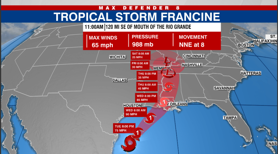
TAMPA, Fla. (WFLA) — Tropical Storm Francine is expected to become a hurricane on Tuesday as it churns in the Gulf of Mexico.
The storm has maximum sustained winds of 65 mph and is located 120 miles southeast of the mouth of the Rio Grande, according to the National Hurricane Center’s 11 a.m. update.
Francine is expected to strengthen significantly as it moves slowly toward the coast. The storm is forecast to make landfall on Wednesday in Louisiana as a hurricane.
The following watches and warnings are in effect:
A Storm Surge Warning is in effect for…
- High Island Texas to the Mississippi/Alabama Border
- Vermilion Bay
- Lake Maurepas
- Lake Pontchartrain
A Hurricane Warning is in effect for…
- The Louisiana coast from Sabine Pass eastward to Grand Isle
A Storm Surge Watch is in effect for…
- Mississippi/Alabama Border to the Alabama/Florida Border
- Mobile Bay
A Tropical Storm Warning is in effect for…
- High Island to Sabine Pass
- Mouth of the Rio Grande to Port Mansfield
- La Pesca Mexico to the Mouth of the Rio Grande
- East of Grand Isle Louisiana to the Mississippi/Alabama border,
including metropolitan New Orleans - Lake Pontchartrain
- Lake Maurepas
A Tropical Storm Watch is in effect for…
- Barra del Tordo to La Pesca Mexico
- Port Mansfield to High Island Texas
- The Alabama coast from the Mississippi/Alabama border to the
Alabama/Florida border
Life-threatening storm surge are expected for the upper Texas and Louisiana coastlines.
Tropical Storm conditions are expected to begin early Wednesday in the southern parts of Louisiana. Mississippi and Louisiana are at risk of flash flooding due to heavy rainfall through Thursday.

Tracking two disturbances in the Atlantic
In the central tropical Atlantic, slight development is expected for an area of low pressure in the next few days, with a 40% chance in the next 48 hours.
According to the NHC, a tropical depression could form within the next few days as it moves westward over the central tropical Atlantic.
Low pressure located hundreds of miles southwest of the Cabo Verde Islands is expected to merge with a strong tropical wave that is located between the west coast of Africa and the Cabo Verde Islands within the next couple of days.
A tropical depression is expected to form as it moves west-northwestward, according to the NHC. There is a 70% chance of development within the next seven days.
