California wildfire managers are offering an interactive view of the massive Line Fire in San Bernardino County.
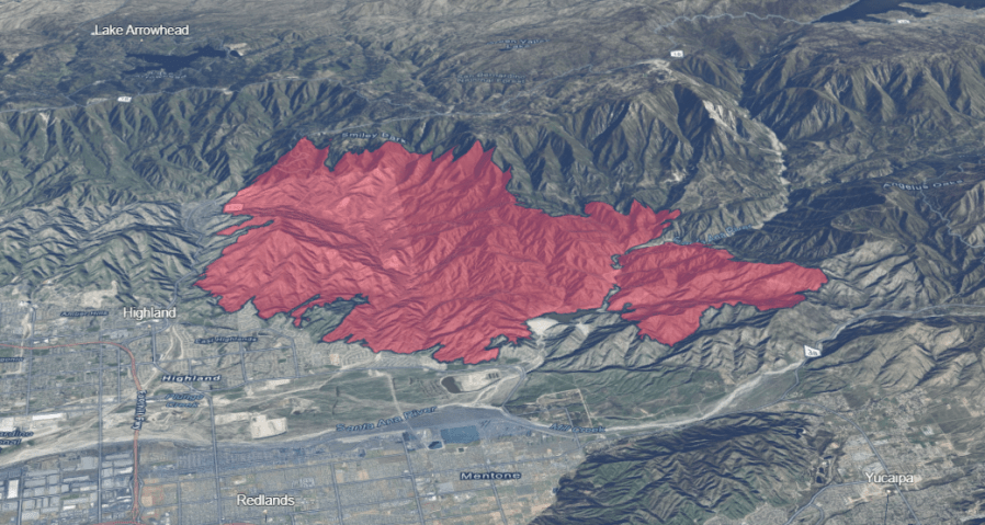
A 3D map shows the current fire perimeter, indicated in red, over a topographic view of the region. Users can rotate the view and zoom to street level and individual homes.
As of Monday afternoon, the Line Fire had scorched 21,000 acres in the San Bernardino National Forest. 36,328 structures were threatened, and tens of thousands of residents remained evacuated from their homes. The fire was first reported last Thursday evening.
The cause of the fire remained under investigation.
Having trouble viewing the map? Tap here to be directed to Cal Fire’s viewer.