Contrast between intense heat and cooler lake breeze behind Tuesday's severe storms

US

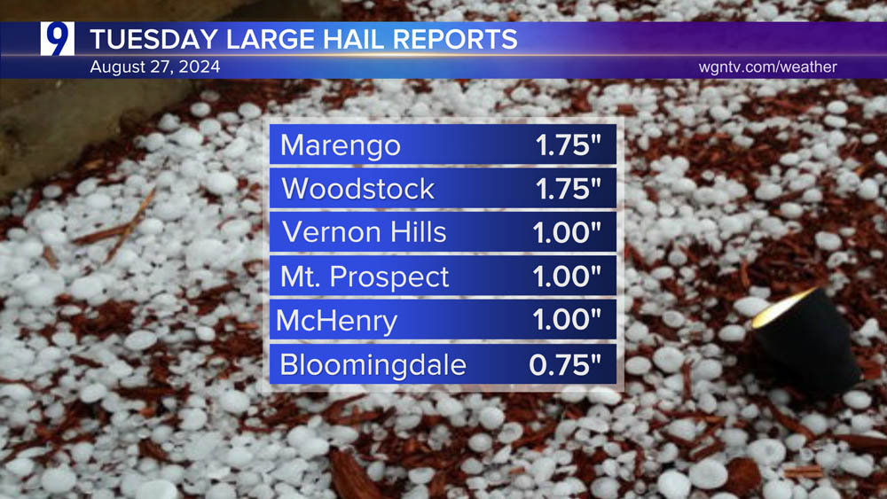
Strong to severe thunderstorms developed Tuesday evening as a lake breeze front interacted with intensely hot, humid air inland. 

Heaviest rainfall totals through 9pm Tuesday

Strongest wind gusts 

Set up behind Tuesday’s developing storms. 

Tuesday’s storms formed on an inland moving lake breeze; a contrast between intense, near 100-degree heat and cooling from 70-degree lake waters off Lake Michigan

College of DuPage GOES-East Satellite/Radar animation depicts how the storms erupted in Tuesday’s late afternoon unstable atmosphere

Scattered thunderstorms are again possible Wednesday, most likely in areas south and east of Chicago where a level 1 of 5 (or marginal risk)  severe risk exists. 

Products You May Like

Articles You May Like

Kamala Harris at DNC summons Americans to reject divisions
DNC Platform Bill Aims to ‘Permanently Increase’ Immigration
College students sought to help NASA return to moon
Spanish film star’s son charged with killing and dismembering plastic surgeon in Thailand faces sentencing
Oakland A’s, led by Joey Estes, beat Milwaukee Brewers, Frankie Montas

Leave a Reply

Your email address will not be published. Required fields are marked *