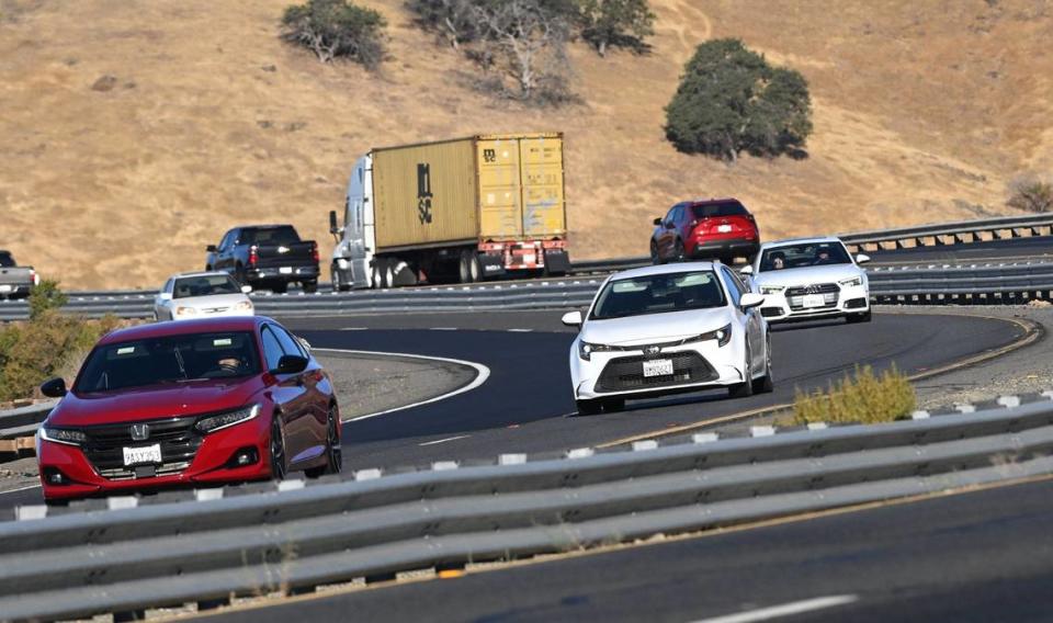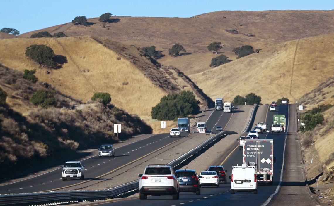
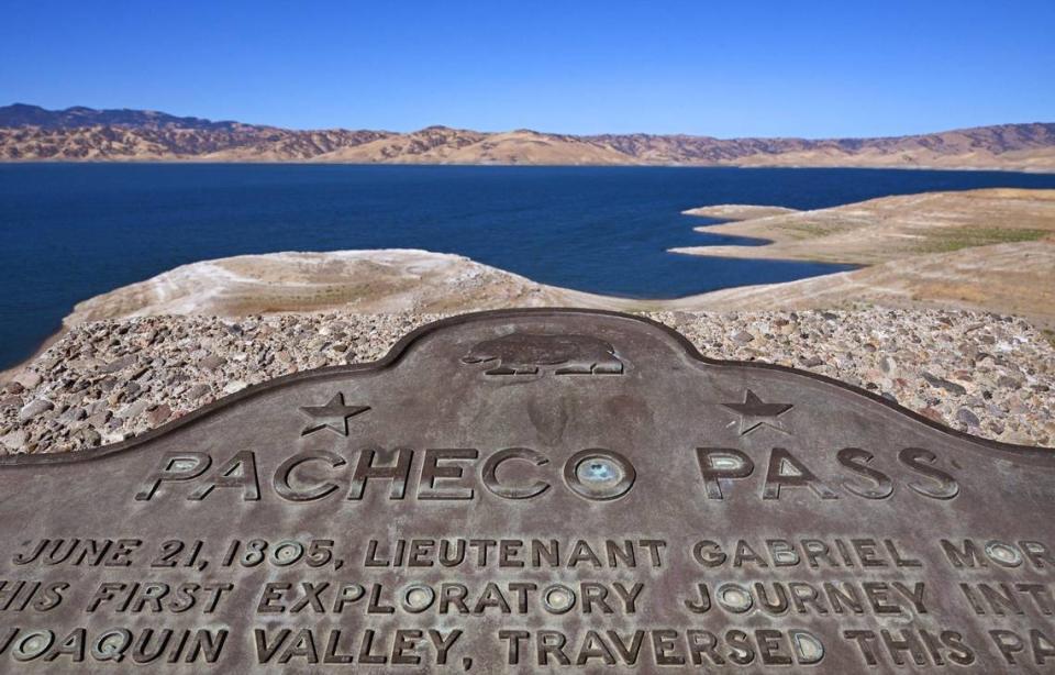
Jesse Torrez’s daily commute between Los Banos and San Jose — consistently rated among the worst in the nation — takes him past the giant holding tank known as San Luis Reservoir, whose shoreline hugs and even crosses Highway 152 on the way to Pacheco Pass.
“Sometimes you can practically reach out and touch (the water),” Torrez said.
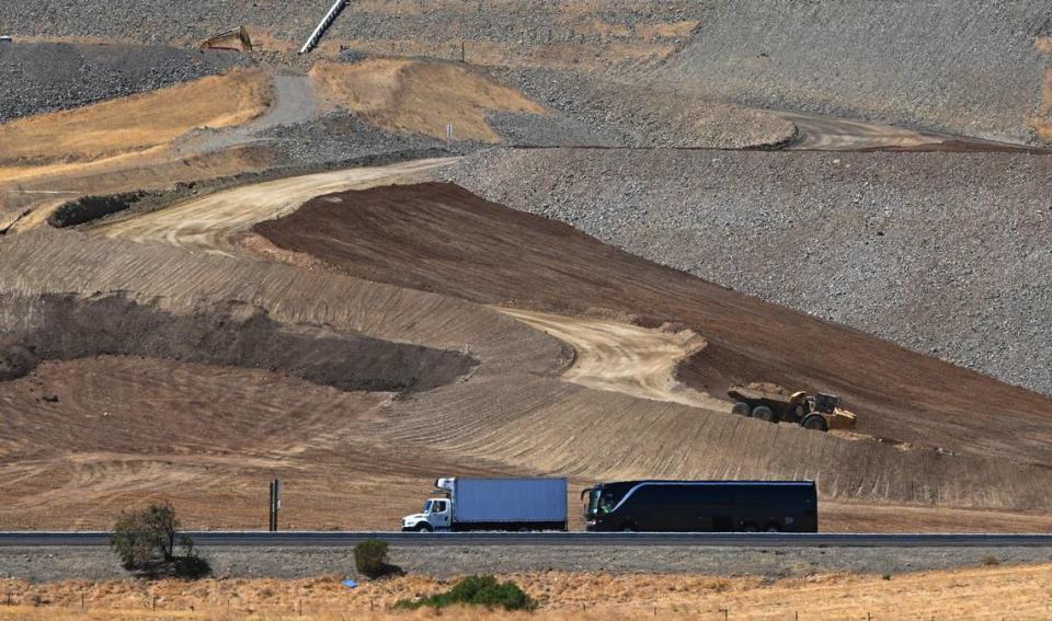
Over the past two years, Torrez has taken notice of ongoing construction activity around the 2 million acre foot reservoir. He’s seen heavy equipment working on the earth dam that rises above the highway and dump trucks delivering tons of material. He knew something major was going on.
But not once — at least not until I became the bearer of bad news — did Torrez have any knowledge or understanding that federally approved plans to raise Sisk Dam and expand the capacity of San Luis Reservoir would make his already taxing commute even worse.
Opinion
“That’s very depressing,” the solar company executive said. “I can’t imagine the mess. I don’t even want to imagine.”
Lane closures on Highway 152 on the east side of Pacheco Pass are the largest — and least discussed — impacts of work currently underway to fortify Sisk Dam against an earthquake and later to add 130,000 feet of storage. The separate $1 billion projects each call for raising the 3½-mile long dam by 10 feet along its crest, for a total raise of 20 feet.
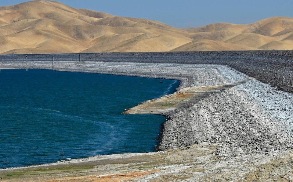
That’s where the highway’s close proximity to the reservoir becomes a problem. The current maximum water level of San Luis is 544 feet of elevation. Near Cottonwood Creek on the lake’s northern shoreline, the roadway elevation is 555 feet at its lowest point.
When the expansion project is completed, the reservoir’s new maximum water level would be 554 feet — approximately one foot below the highway.
“It is assumed that modifications will be needed to protect the roadway from wave action,” reads the project’s final Environmental Impact Report.
Considering San Luis Reservoir is known for its wind and whitecaps, that seems a safe assumption.
Lane closures required
To protect Highway 152 from flooding, the environmental impact report proposes raising the embankment by 11 feet along the ⅔-mile stretch where it crosses Cottonwood Creek in addition to other modifications at that site and at a nearby parking overlook.
Those alternations to 152 would require approximately two years and take place concurrently with the dam raising. Work is projected to begin in 2027. During the latter part of those two years, the four-lane roadway would be reduced to single lanes in each direction for “approximately 8 to 12 months during the scheduled period of construction.”
Torrez frowned when informed of the planned lane closures. His commute takes 90 minutes in the morning and 95 in the afternoon (“Those are very accurate times because I do it every day,” he says) but only because he leaves home between 4 and 4:30 a.m. and departs work at 2 p.m. to beat the worst of traffic.
Even at those times, traffic on 152 is continuous. Now imagine the bottlenecks created by single lanes in a construction zone projected to last up to one year.
“That is going to have a huge impact on a lot of people’s lifestyles,” Torrez said. “My schedule is my schedule. I don’t have any more hours left to give.”
When Deborah Lewis moved to Los Banos in 1989, she was one of the few residents who commuted over Pacheco Pass for work.
“It was me and one or two trucks on the road,” she said. “There wasn’t anybody.”
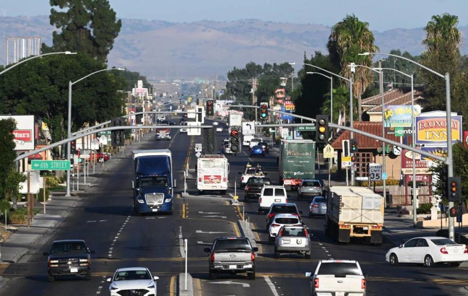
Not so much today. As a longtime city council member, Lewis has witnessed the city’s transformation from small farm town to burgeoning bedroom community of 47,000 residents — much of that due to Silicon Valley workers who can’t afford the sky-high Bay Area home prices. The same is true, on a smaller scale, for nearby communities of Santa Nella and Gustine located along Interstate 5.
Residents in the dark
Two years ago, when the seismic work on Sisk Dam began, Lewis attended the ribbon-cutting ceremony hosted by the Bureau of Reclamation. She recalled no mention of lane closures or impacts to the busy highway.
“Nothing,” Lewis said. “No information is being disseminated to our community about what is going to happen. I don’t want this to be a surprise for commuters.”
With highway modifications expected to begin no sooner than 2027, a traffic control plan has yet to be designed. According to the vaguely worded environmental report, temporary signage will be installed to warn motorists of lane closures “at least one month in advance to plan for delays or alternate routes.”
That’s a laugh. For central San Joaquin Valley commuters, there are no alternate routes. The only other freeway to the Bay Area — Interstate 580 over Altamont Pass — is hours out of the way and even more congested.
Henry Garcia, the Bureau of Reclamation’s project manager for Sisk Dam, is sympathetic. Every evening when he leaves the job site, simply making a right turn onto 152 toward Los Banos is no simple feat.
“We want to work with Caltrans and our partners to minimize impacts,” Garcia said. “How can we do this with the least amount of impact to the public? It’s a challenge on 152. There is not much room to do the necessary work.”
Construction on Sisk Dam has already necessitated the decade-long closures of campgrounds, picnic areas and a boat launch ramp at San Luis Reservoir State Reservation Area. Boaters must launch at Dinosaur Point, which forces them to make a left-hand turn against oncoming traffic in an area known for high speeds and fog.
But the biggest headache, constricting Highway 152 over Pacheco Pass for up to a year, a commuter’s nightmare, has been kept under wraps.