HOUSTON, Texas (KTRK) — While temperatures reaching the mid-upper 90s Sunday, if it didn’t feel “as hot” it’s because of the lower humidity. Unfortunately, this “drier heat” wont stick around with humidity levels increasing early in the week. However, the return of more tropical moisture will give way to a few small rain chances.
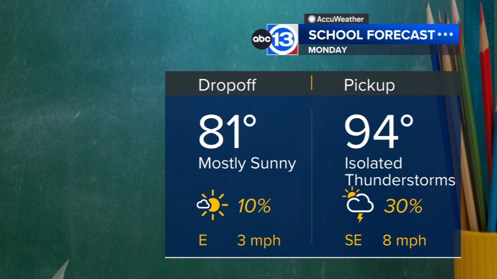
Temperatures Sunday night will fall to upper 70s overnight, and you might notice that it could feel a bit more humid tonight. This, paired with afternoon highs back in the mid-upper 90s, heat index values will approach that 108-degree mark Sunday afternoon. And with the addition of more humid air in Southeast Texas, an isolated shower or storm cant be ruled out Monday. Best chance for that will be in the afternoon or early evening and along or south of I-10.
Besides Monday, are there any other chances for showers and storms this week?
Monday and Tuesday’s rain chances are based on an afternoon sea breeze that could move inland. That being said, it’s not a widespread rain chance… much more hit or miss. Monday and Tuesday it’s only a 30% chance for rain, then that drops to 20% for Wednesday and Thursday. So if a passing shower or storm moves through your neighborhood this week, you’re lucky! Beyond Thursday, there is no prominent rain chance for potential the next 7 days or more.
What are you tracking in the tropics?
A tropical wave in the central Atlantic is now Potential Storm Five. This wave will likely become Ernesto early this week. Head to our daily Tropical Update page for the latest on what’s happening in the tropics.
13 ALERT RADAR MAPS:
Montgomery/Walker/San Jacinto/Polk/Grimes Counties
Fort Bend/Wharton/Colorado Counties
Have weather tips, videos, and photos?
Send it to ABC13 using the form below. If you have a video or photo to send, terms of use apply. If you don’t, just hit ‘skip upload’ and send the details.
Copyright © 2024 KTRK-TV. All Rights Reserved.