While still a tropical storm, Debby is nearing hurricane strength, producing maximum sustained wind speeds up to 70 mph.
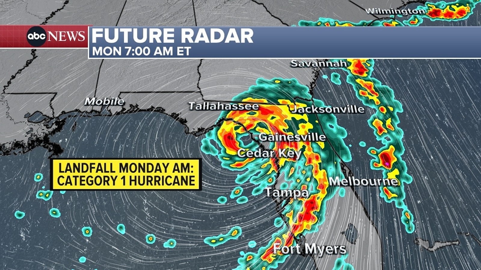
Debby will continue to intensify rapidly overnight as it travels northward over the Gulf’s warm waters. It is forecast to become a hurricane tonight. It is expected to strengthen to at least a strong Category 1 hurricane before making landfall along Florida’s Big Bend region Monday morning (around 7 a.m. ET), producing sustained wind speeds near 85 mph and wind gusts reaching over 100 mph possible.
Located about 90 miles southwest of Cedar Key, Florida, the storm continues to impact the Florida Gulf Coast with heavy rainfall, storm surge, powerful winds and even spin-up tornadoes.
A reported wind gust of 56 mph was reported in St. Petersburg, with two tornadoes reported in central Florida.
A 60-mph wind gust was also reported near Sarasota, Florida.
Numerous reports of flooding from heavy rainfall and surges have also been submitted up Florida’s Gulf Coast.
The Tornado Watch covering much of northern and central Florida and southern Georgia has been extended until 6 a.m. ET on Monday.
Once Debby moves over land, it will weaken. However, the lack of a steering current will cause the storm to slow down considerably. While its exact track remains questionable, model guidance suggests the storm will drift over the Atlantic or Southeast coastline late Monday night into Tuesday before meandering back over Georgia and the Carolinas. Interaction with the Atlantic could reenergize Debby, but that will greatly depend on the storm’s path.
Even though Debby’s track and timing remain uncertain later this week, there is high confidence that it will bring historic rainfall and significant flooding across portions of the Southeast.
Rainfall ranging between 6 to 12 inches is possible from Florida’s Big Bend region through southeastern Georgia and into the Carolinas. Parts of coastal Georgia and South Carolina will be in the bullseye for the heaviest rainfall. There, widespread totals between 10 to 20 inches are possible, with some places even seeing up to 30 inches locally. Because of this, significant urban and river flooding is anticipated.
Rainfall aside, hurricane and tropical storm force winds will continue to whip across Florida and will likely intensify Sunday night into Monday as the storm moves closer to the coast — with areas just south and east of the storm’s eyewall seeing the strongest gusts early Monday morning.
Storm surge will also worsen along Florida’s northern and central Gulf coast tonight into Monday morning, with the highest surge expected between Suwannee River and Ochlockonee River (6 to 10 feet).
All tropical alerts remain unchanged from the last update.
-ABC News meteorologist Shawnie Caslin Martucci