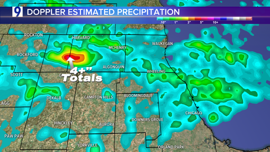
Localized, but drenching thunderstorm downpours impacted parts of the area late Tuesday afternoon and evening, including 1.02″ in just 16 minutes at Midway Airport according to Frank Wachowski.

Following isolated showers/t-storms Wednesday morning, quieter weather settles in the rest of the workweek. The next chance of seeing a shower or thunderstorm comes this weekend as heat and humidity build.

Texas Rains: Heavy rain is forecast for Southeast Texas, the South, and the Southeast for the next few days. Widespread 2-4” totals expected, locally higher in spots. Localized to scattered flash flooding is also possible:


