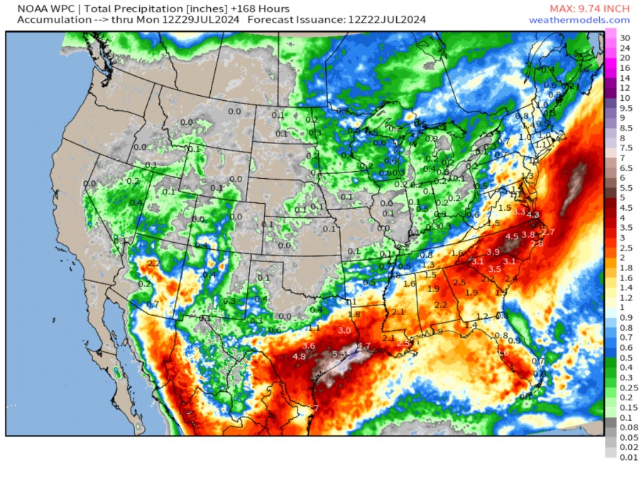
Not at all uncommon when dealing with summertime thunderstorms. Heaviest totals to focus along the Gulf Coast and Southeastern U.S.
TOTAL RAINFALL THROUGH MONDAY, JULY 29th:
Tracking the potential for scattered showers and thunderstorms the next two days based on the latest HRRR model

Expect to see some increased hazy skies the next couple of days as wildfires out west continue to burn. Upper steering jet stream winds will pull some of that smoke aloft into the Chicagoland area.

Rain chances look fairly low much of this week, peaking on Wednesday when at least half the metro area is likely to see a shower or thunderstorm.
