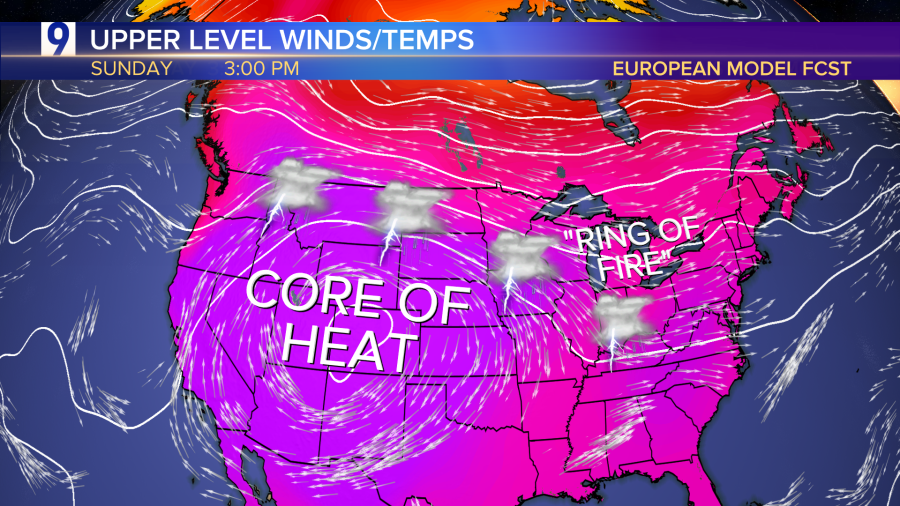
Steering winds aloft and the ‘Ring of Fire’
A prod of the western heat is expected to slide east into the Midwest and Chicago area, but steering winds aloft will have a northwesterly component, keeping daily chances for thunderstorms in the forecast as the core of the hot air dome sits well west of Chicago. The storm risk is part of a “ring of fire” pattern that refers to the path that thunderstorms take around the periphery of a heat dome or a high-pressure center.
FORECAST SUNDAY AFTERNOON
Predicted high temperatures and departures from normal
