A flash flood warning has been issued for Texas as Hurricane Beryl intensifies.
Initially a storm, Beryl strengthened into a hurricane last Saturday, becoming June’s easternmost major hurricane in the Atlantic. The storm underwent rapid intensification and became a Category 4 hurricane as soon as its wind speeds reached 130 mph.
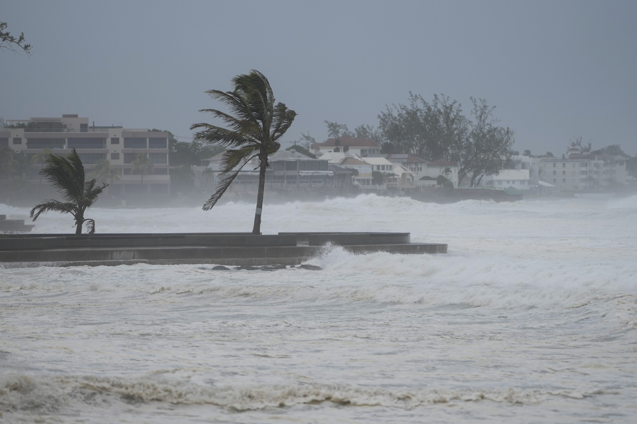
At one point, Hurricane Beryl was categorized as a Category 5, but it has since weakened again to a Category 2, with wind speeds at 110 mph as of Friday morning, when the storm made landfall near Tulum, Mexico.
The storm is forecast to continue across the Gulf of Mexico, hitting southern Texas early on Monday morning, and is expected to strengthen again on its journey, slamming into the state as a hurricane-strength storm.
AP Photo/Ricardo Mazalan
The National Weather Service (NWS) issued an update saying: “Tropical Cyclone Beryl is forecast to bring heavy rain to parts of Texas Sunday through mid next week, which will likely result in flash and urban flooding, some of which may be locally considerable.”
Meanwhile, a tropical storm warning was in place in the Gulf just south of Texas as of Friday morning, according to NWS.
“There is an increasing risk of strong winds, storm surge, and heavy rainfall in portions of northeastern Mexico and southern Texas late this weekend,” the NHC forecast said. “Interests in these areas should closely monitor the progress of Beryl and updates to the forecast. Hurricane and Tropical Storm Watches will likely be issued later today.”
Deadly rip currents are also expected to begin along the Texas coast later on Friday. They will continue throughout much of the weekend.
Texas officials have suggested that residents take steps now to prepare for Hurricane Beryl’s impending landfall, such as fueling their cars.
Texas Gov. Greg Abbott ordered the state Division of Emergency Management to increase readiness levels for potential impacts of Beryl on Thursday. On Wednesday, he directed the department to issue advisories to the 39 state Emergency Management Council Agencies to prepare response efforts.
During a briefing, Texas Lt. Gov. Dan Patrick said: “We pray and we hope for nothing more of a rain event, but even a rain event may be very heavy. We prepare at the state for the worst-case scenario.”
“Everyone along the coast should be paying attention to this storm,” he added.
Multiple agencies, including the National Oceanic and Atmospheric Administration, have issued forecasts warning that 2024 will be an exceptionally strong year for hurricanes.
Several factors are contributing to this year’s storm-heavy predictions, including abnormally warm sea surface temperatures and the expectation that El Nino will transition into La Nina by this summer or fall.
Uncommon Knowledge
Newsweek is committed to challenging conventional wisdom and finding connections in the search for common ground.
Newsweek is committed to challenging conventional wisdom and finding connections in the search for common ground.