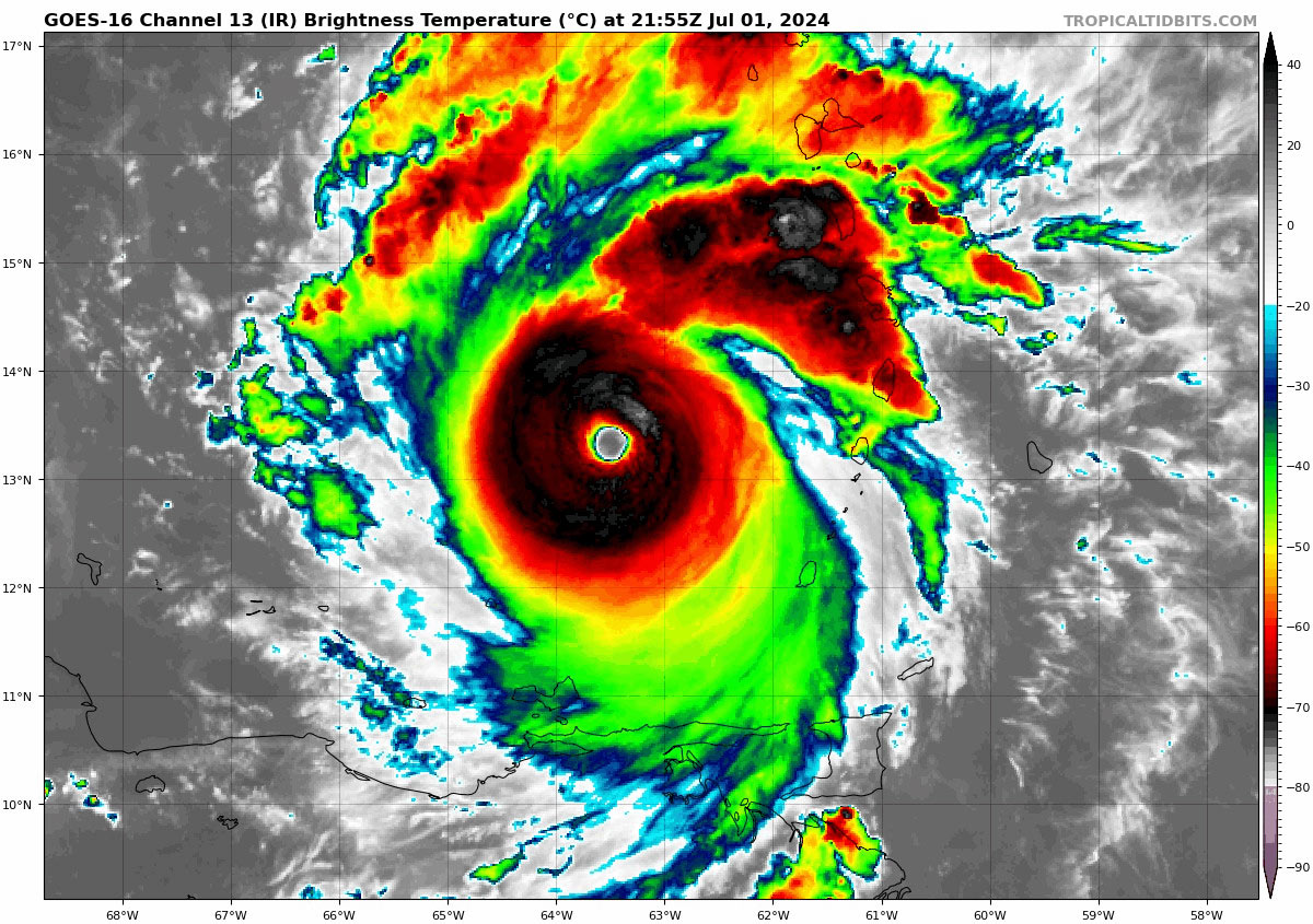
Impressive Infrared Satellite imagery of powerful CAT. 5 hurricane Beryl which has intensified to a Category 5 hurricane with max winds of 160 mph
This is the earliest calendar year Atlantic Category 5 hurricane on record. The prior record was Hurricane Emily July 17, 2005 which topped out as a category 5 storm with 160 mph winds.
Only a handful of eastern Caribbean hurricanes of had a storm of this intensity. Beryl is indeed in elite company:
- Inez in 1966
- David in 1979
- Allen in 1980
- Lenny in 1999
- Ivan in 2004
- Dean in 2007
- Felix 2007
- Matthew in 2016
- Irma in 2017
- Maria in 2017
Source: Dr. Philip Klotzbach, Colorado State University
The possibility of a northward bend in the storm track

Beryl taking aim towards Jamaica at slightly less intensity by early Wednesday before west into the Yucatan Peninsula.

When can tropical storm force winds be expected?


CURRENT WATCHES/WARNINGS:
A Hurricane Warning is in effect for: JAMAICA
A Tropical Storm Warning is in effect for:
- South coast of Dominican Republic from Punta Palenque westward to the border with Haiti.
- South coast of Haiti from the border with the Dominican Republic to Anse d’Hainault.
Interests elsewhere in the Cayman Islands, and the remainder of the northwestern Caribbean should closely monitor the progress of Beryl. Additional watches or warnings may be required throughout the day on Tuesday.
NOTE: A Hurricane Warning means that hurricane conditions are expected somewhere within the warning area. A warning is typically issued 36 hours before the anticipated first occurrence of tropical-storm-force winds, conditions that make outside preparations difficult or dangerous. A Tropical Storm Warning means that tropical storm conditions are expected somewhere within the warning area within 36 hours.
RAINFALL EXPECTED:
