Posted:
Updated:
Storms re-erupted late Tuesday afternoon and evening, producing multiple brief tornado touchdowns and funnel clouds in Iowa and Nebraska.
Updated list of Tuesday’s storm reports…
Map of Tuesday’s tornado reports:


Powerful t-storms produced damaging gusts and large hail outside the Chicago metro area…


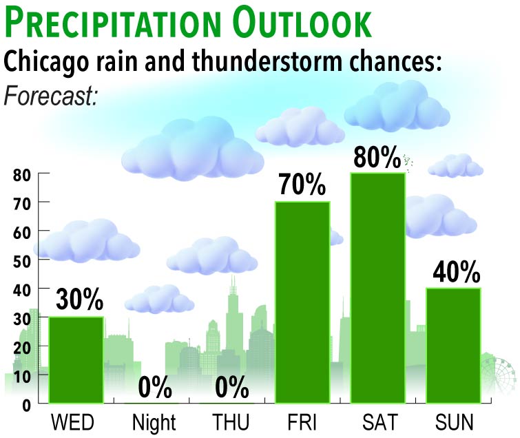
More Chicago showers and storms are expected Friday into Saturday…

Cloudy open to the day Wednesday, perhaps a lingering shower in spots. Clouds should break beyond midday, setting up mostly sunny skies by mid-afternoon…


WEDNESDAY SEVERE OUTLOOK
Severe thunderstorms will be possible across portions of the Northeast and Mid-Atlantic as a cold front slides through later in the day Wednesday. The biggest risk will be damaging wind gusts.

Tracking the arrival Friday of the next round of notable showers and thunderstorms…

Potential for additional soaking rainfall across the corn belt and Great Lakes ahead over the next week.
Blended model forecast through next Tuesday, July 2nd.
