Posted:
Updated:
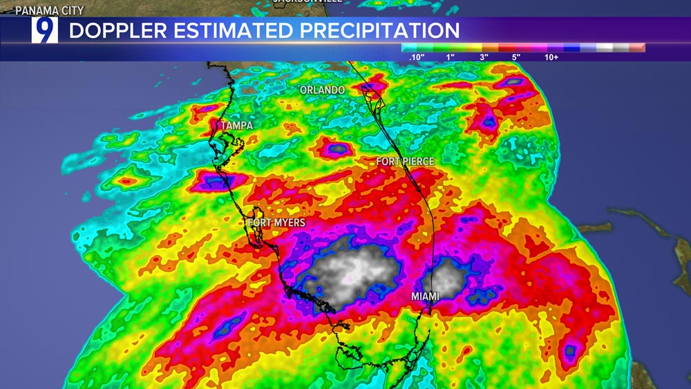
Dangerous deluge in south Florida
Rainfall totals past 48 hours:
Doppler radar map of heavy rainfall:

Infrared satellite imagery impressive over Florida

An elongated area of low pressure over the Florida peninsula continues to produce a large area of disorganized showers and thunderstorms.
Although upper-level winds are expected to be only marginally conducive, some slow development is possible while the system moves northeastward offshore of the U.S. Southeast coast tonight through late week.

* Formation chance through 48 hours…low…10 percent.
* Formation chance through 7 days…low…20 percent.